 Old Cumbria Gazetteer
 |
 |
|
| Nag's Head, Hoff | ||
| Nag's Head | ||
| civil parish:- | Hoff (formerly Westmorland) | |
| county:- | Cumbria | |
| locality type:- | buildings | |
| coordinates:- | NY65821694 | |
| 1Km square:- | NY6516 | |
| 10Km square:- | NY61 | |
|
|
||
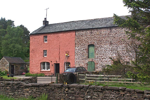 BME57.jpg (taken 30.5.2006) |
||
|
|
||
| evidence:- | old map:- OS County Series (Wmd 15 10) placename:- Nag's Head Inn |
|
| source data:- | Maps, County Series maps of Great Britain, scales 6 and 25
inches to 1 mile, published by the Ordnance Survey, Southampton,
Hampshire, from about 1863 to 1948. |
|
|
|
||
| evidence:- | database:- Listed Buildings 2010 placename:- Nags Head Farm |
|
| source data:- | courtesy of English Heritage "NAGS HEAD FARMHOUSE AND ATTACHED BYRE / / / HOFF / EDEN / CUMBRIA / II / 73282 / NY6582316942" |
|
|
|
||
 Lakes Guides menu.