 Old Cumbria Gazetteer
 |
 |
|
| Near Howe, Mungrisdale | ||
| Near Howe | ||
| locality:- | Underhow | |
| civil parish:- | Mungrisdale (formerly Cumberland) | |
| county:- | Cumbria | |
| locality type:- | buildings | |
| coordinates:- | NY37392876 | |
| 1Km square:- | NY3728 | |
| 10Km square:- | NY32 | |
|
|
||
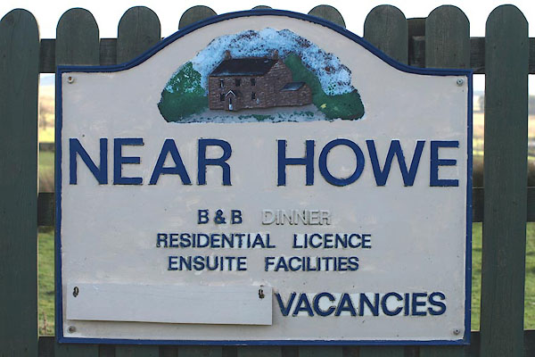 BOP09.jpg Cast iron house name sign. (taken 6.2.2008) |
||
|
|
||
| evidence:- | probably old map:- Donald 1774 (Cmd) placename:- How |
|
| source data:- | Map, hand coloured engraving, 3x2 sheets, The County of Cumberland, scale about 1
inch to 1 mile, by Thomas Donald, engraved and published by Joseph Hodskinson, 29
Arundel Street, Strand, London, 1774.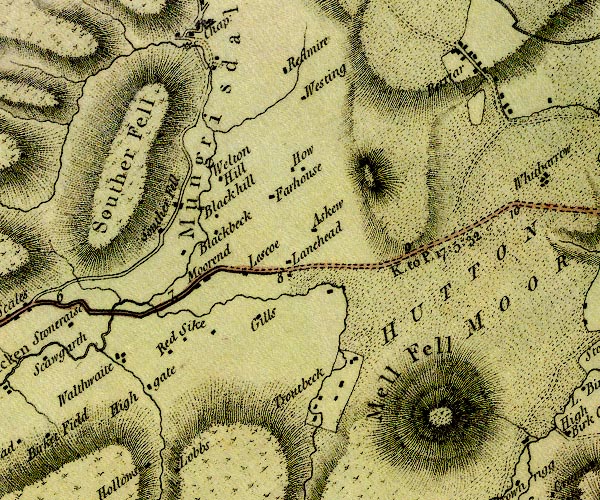 D4NY32NE.jpg "How" block or blocks, labelled in lowercase; a hamlet or just a house item:- Carlisle Library : Map 2 Image © Carlisle Library |
|
|
|
||
 Lakes Guides menu.