 Old Cumbria Gazetteer
 |
 |
|
| Old Hall, Rockcliffe | ||
| Old Hall | ||
| locality:- | Castletown | |
| civil parish:- | Rockcliffe (formerly Cumberland) | |
| county:- | Cumbria | |
| locality type:- | buildings | |
| coordinates:- | NY35446194 | |
| 1Km square:- | NY3561 | |
| 10Km square:- | NY36 | |
|
|
||
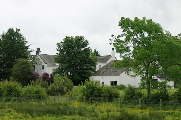 BWT70.jpg (taken 15.6.2012) |
||
|
|
||
| evidence:- | old map:- OS County Series (Cmd 16 5) placename:- Rockcliff Hall |
|
| source data:- | Maps, County Series maps of Great Britain, scales 6 and 25
inches to 1 mile, published by the Ordnance Survey, Southampton,
Hampshire, from about 1863 to 1948. |
|
|
|
||
| evidence:- | old map:- OS County Series (Cmd 16) placename:- Rockcliff Hall |
|
| source data:- | Maps, County Series maps of Great Britain, scales 6 and 25
inches to 1 mile, published by the Ordnance Survey, Southampton,
Hampshire, from about 1863 to 1948. "Rockcliff Hall" |
|
|
|
||
| evidence:- | database:- Listed Buildings 2010 placename:- Old Hall |
|
| source data:- | courtesy of English Heritage "THE OLD HALL / / / ROCKCLIFFE / CARLISLE / CUMBRIA / II / 77944 / NY3544361944" |
|
|
|
||
 Lakes Guides menu.