 Old Cumbria Gazetteer
 |
 |
|
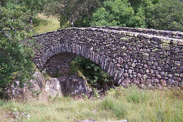
| packhorse bridge, Wet Sleddale | ||
| site name:- | Lowther, River | |
| locality:- | Wet Sleddale | |
| civil parish:- | Shap Rural (formerly Westmorland) | |
| county:- | Cumbria | |
| locality type:- | packhorse bridge | |
| locality type:- | bridge | |
| coordinates:- | NY54021099 | |
| 1Km square:- | NY5410 | |
| 10Km square:- | NY51 | |
| references:- | Hinchcliffe, Ernest: 1994: Packhorse Bridges of England: Cicerone Press (Milnthorpe,
Cumbria) |
|
|
|
||
 BJT50.jpg (taken 22.8.2005) |
||
|
|
||
| :- |
17th century bridge, would have been flooded by Wet Sleddale Reservoir. It was dismantled
and re-erected, parapets added. 30 foot span, 72 ins between parapets. |
|
| Hinchcliffe, Ernest: 1994: Packhorse Bridges of England: Cicerone Press (Milnthorpe,
Cumbria) |
||
|
|
||
 Lakes Guides menu.