 Old Cumbria Gazetteer
 |
 |
|
| Penton Station, Nicholforest | ||
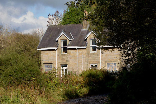
| Station House | ||
| Penton Station | ||
| site name:- | Border Union Railway | |
| locality:- | Penton | |
| civil parish:- | Nicholforest (formerly Cumberland) | |
| county:- | Cumbria | |
| locality type:- | railway station | |
| coordinates:- | NY43947731 | |
| 1Km square:- | NY4377 | |
| 10Km square:- | NY47 | |
| SummaryText:- | Opened 1862; closed 1969. | |
|
|
||
 CGT51.jpg (taken 20.10.2017) 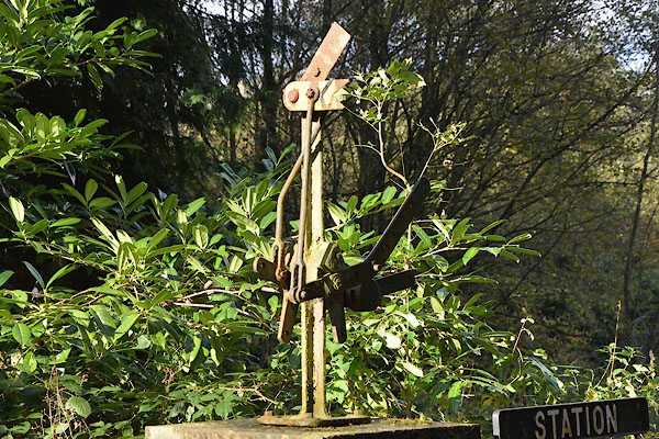 CGT52.jpg Decoration on gate pier. (taken 20.10.2017) |
||
|
|
||
| evidence:- | old map:- OS County Series (Cmd 3 13) placename:- Penton Station item:- railway signal; railway milepost; weigh bridge |
|
| source data:- | Maps, County Series maps of Great Britain, scales 6 and 25
inches to 1 mile, published by the Ordnance Survey, Southampton,
Hampshire, from about 1863 to 1948.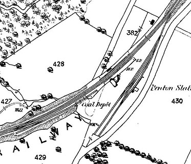 click to enlarge click to enlargeCSRY0035.jpg "Penton Station / Coal Depot / S.P. / M.P. / W.M." |
|
|
|
||
 Lakes Guides menu.