 Old Cumbria Gazetteer
 |
 |
|
| Petteril Green, Hesket | ||
| Petteril Green | ||
| civil parish:- | Hesket (formerly Cumberland) | |
| county:- | Cumbria | |
| locality type:- | buildings | |
| coordinates:- | NY47594157 | |
| 1Km square:- | NY4741 | |
| 10Km square:- | NY44 | |
|
|
||
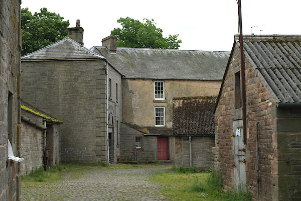 BWS18.jpg (taken 8.6.2012) |
||
|
|
||
| evidence:- | old map:- OS County Series (Cmd 39 7) placename:- Petterill Green |
|
| source data:- | Maps, County Series maps of Great Britain, scales 6 and 25
inches to 1 mile, published by the Ordnance Survey, Southampton,
Hampshire, from about 1863 to 1948. |
|
|
|
||
| evidence:- | old map:- Ford 1839 map placename:- Petteril Green |
|
| source data:- | Map, uncoloured engraving, Map of the Lake District of
Cumberland, Westmoreland and Lancashire, scale about 3.5 miles
to 1 inch, published by Charles Thurnam, Carlisle, and by R
Groombridge, 5 Paternoster Row, London, 3rd edn 1843.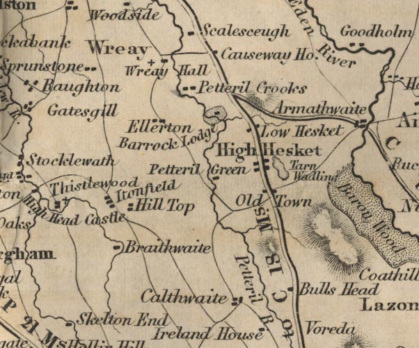 FD02NY44.jpg "Petteril Green" item:- JandMN : 100.1 Image © see bottom of page |
|
|
|
||
| evidence:- | database:- Listed Buildings 2010 |
|
| source data:- | courtesy of English Heritage "PETTERIL GREEN AND REAR STABLES / / / HESKET / EDEN / CUMBRIA / II / 73899 / NY4759441574" |
|
|
|
||
| evidence:- | database:- Listed Buildings 2010 |
|
| source data:- | courtesy of English Heritage "BARNS ADJOINING PETTERIL GREEN / / / HESKET / EDEN / CUMBRIA / II / 73900 / NY4759041625" |
|
|
|
||
 Lakes Guides menu.