 Old Cumbria Gazetteer
 |
 |
|
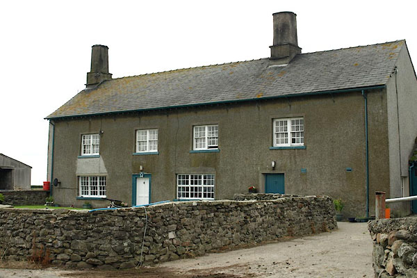
| Raven Winder, Lower Holker | ||
| Raven Winder | ||
| civil parish:- | Lower Holker (formerly Lancashire) | |
| county:- | Cumbria | |
| coordinates:- | SD35837440 | |
| 1Km square:- | SD3574 | |
| 10Km square:- | SD37 | |
|
|
||
 BZA65.jpg (taken 9.8.2013) 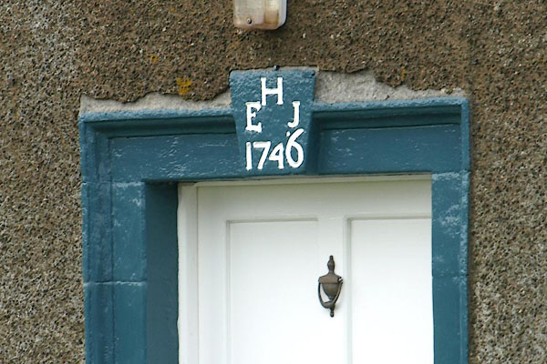 BZA66.jpg Date stone:- "H / E J / 1746" (taken 9.8.2013) |
||
|
|
||
| evidence:- | old map:- OS County Series (Lan 17 10) placename:- Raven Winder |
|
| source data:- | Maps, County Series maps of Great Britain, scales 6 and 25
inches to 1 mile, published by the Ordnance Survey, Southampton,
Hampshire, from about 1863 to 1948. |
|
|
|
||
| evidence:- | presumably database:- Listed Buildings 2010 placename:- Raven Windsor item:- date stone (1746) |
|
| source data:- | courtesy of English Heritage "RAVEN WINDSOR ON WINDER MOOR / / WINDER LANE / LOWER HOLKER / SOUTH LAKELAND / CUMBRIA / II / 77087 / SD3583974406" |
|
|
|
||
 Lakes Guides menu.