 Old Cumbria Gazetteer
 |
 |
|
| Roehead, Barton | ||
| Roehead | ||
| civil parish:- | Barton (formerly Westmorland) | |
| county:- | Cumbria | |
| locality type:- | buildings | |
| coordinates:- | NY47922371 | |
| 1Km square:- | NY4723 | |
| 10Km square:- | NY42 | |
|
|
||
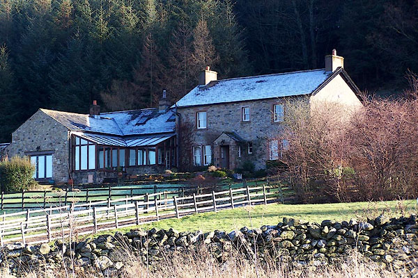 BLN30.jpg (taken 4.1.2006) 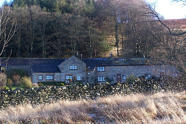 BLN31.jpg (taken 4.1.2006) |
||
|
|
||
| evidence:- | old map:- OS County Series (Wmd 7) placename:- Row Head |
|
| source data:- | Maps, County Series maps of Great Britain, scales 6 and 25
inches to 1 mile, published by the Ordnance Survey, Southampton,
Hampshire, from about 1863 to 1948. "Row Head" |
|
|
|
||
| evidence:- | old map:- OS County Series (Wmd 7 10) placename:- Rowhead |
|
| source data:- | Maps, County Series maps of Great Britain, scales 6 and 25
inches to 1 mile, published by the Ordnance Survey, Southampton,
Hampshire, from about 1863 to 1948. |
|
|
|
||
| evidence:- | hearth tax returns:- Hearth Tax 1675 placename:- Rawhead |
|
| source data:- | Records, hearth tax survey returns, Westmorland, 1674/75. "Rawhead" in "Barton above the Church" |
|
|
|
||
| evidence:- | old map:- Clarke 1787 map (Ullswater) placename:- Row Head |
|
| source data:- | Map, A Map of the Lake Ullswater and its Environs, scale about
6.5 ins to 1 mile, by James Clarke, engraved by S J Neele, 352
Strand, published by James Clarke, Penrith, Cumberland and in
London etc, 1787.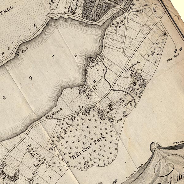 CL4NY42R.jpg "Row Head" item:- private collection : 10.4 Image © see bottom of page |
|
|
|
||
| evidence:- | database:- Listed Buildings 2010 placename:- Roehead |
|
| source data:- | courtesy of English Heritage "ROEHEAD AND ATTACHED OUTBUILDINGS / / / BARTON / EDEN / CUMBRIA / II / 74498 / NY4792423648" |
|
|
|
||
 Lakes Guides menu.