 Old Cumbria Gazetteer
 |
 |
|
| Sheep Island, Walney Island | ||
| Sheep Island | ||
| locality:- | Walney Island | |
| civil parish:- | Barrow-in-Furness (formerly Lancashire) | |
| county:- | Cumbria | |
| locality type:- | island | |
| coordinates:- | SD214639 | |
| 1Km square:- | SD2163 | |
| 10Km square:- | SD26 | |
|
|
||
| evidence:- | old map:- OS County Series (Lan 27 8) placename:- Sheep Island |
|
| source data:- | Maps, County Series maps of Great Britain, scales 6 and 25
inches to 1 mile, published by the Ordnance Survey, Southampton,
Hampshire, from about 1863 to 1948. |
|
|
|
||
| evidence:- | old map:- West 1784 map placename:- Sheep Isle |
|
| source data:- | Map, hand coloured engraving, A Map of the Lakes in Cumberland,
Westmorland and Lancashire, scale about 3.5 miles to 1 inch,
engraved by Paas, 53 Holborn, London, about 1784.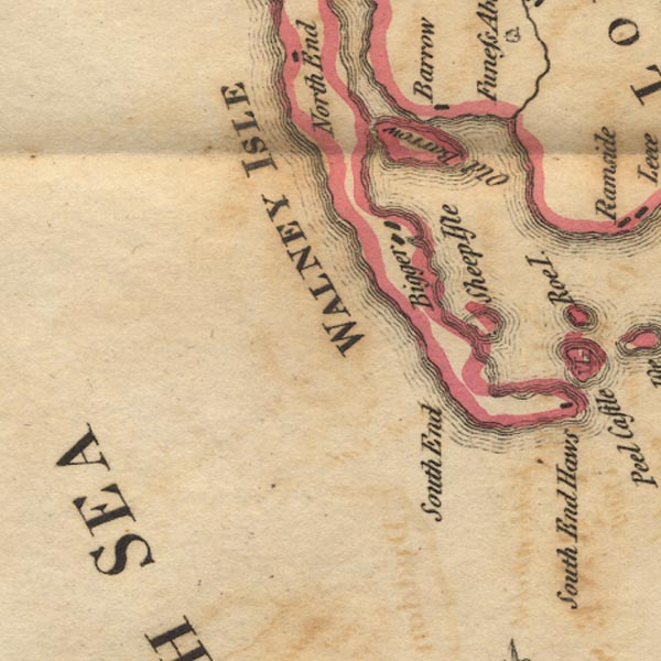 Ws02SD16.jpg item:- Armitt Library : A1221.1 Image © see bottom of page |
|
|
|
||
| hearsay:- |
There are the remains of a hospital on the island. A ship arriving in Walney Channel
with yellow fever aboard had to fly the quarantine flag, yellow. The sick were put
off on the island. |
|
|
|
||
 Lakes Guides menu.