 Old Cumbria Gazetteer
 |
 |
|
| Side House, Great Langdale | ||
| Side House | ||
| locality:- | Great Langdale | |
| civil parish:- | Lakes (formerly Westmorland) | |
| county:- | Cumbria | |
| locality type:- | buildings | |
| coordinates:- | NY29540604 | |
| 1Km square:- | NY2906 | |
| 10Km square:- | NY20 | |
|
|
||
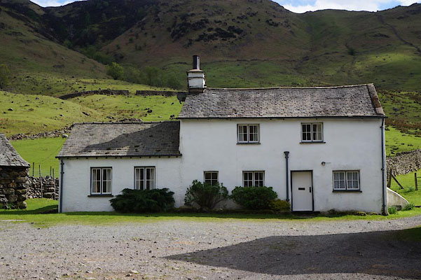 CAN97.jpg (taken 2.5.2014) 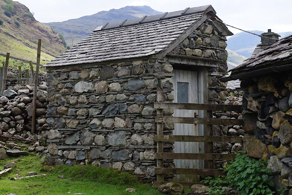 CAN98.jpg Privy. (taken 2.5.2014) |
||
|
|
||
| evidence:- | old map:- OS County Series (Wmd 25 7) placename:- Side House |
|
| source data:- | Maps, County Series maps of Great Britain, scales 6 and 25
inches to 1 mile, published by the Ordnance Survey, Southampton,
Hampshire, from about 1863 to 1948. |
|
|
|
||
| evidence:- | old map:- Jefferys 1770 (Wmd) placename:- Side |
|
| source data:- | Map, 4 sheets, The County of Westmoreland, scale 1 inch to 1
mile, surveyed 1768, and engraved and published by Thomas
Jefferys, London, 1770.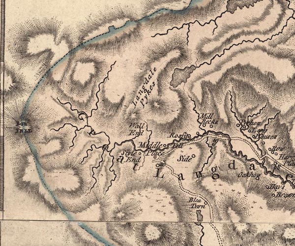 J5NY20NE.jpg "Side" circle, labelled in italic lowercase text; settlement, farm, house, or hamlet? item:- National Library of Scotland : EME.s.47 Image © National Library of Scotland |
|
|
|
||
| evidence:- | old map:- Cary 1789 (edn 1805) placename:- Side |
|
| source data:- | Map, uncoloured engraving, Westmoreland, scale about 2.5 miles
to 1 inch, by John Cary, London, 1789; edition 1805.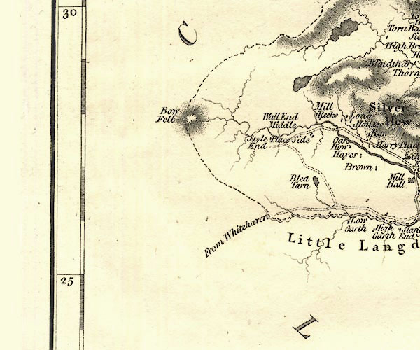 CY24NY20.jpg "Side" block/s, labelled in italic lowercase; house, or hamlet item:- JandMN : 129 Image © see bottom of page |
|
|
|
||
| evidence:- | old drawing:- Green 1790s-1820s (1808) placename:- Side House |
|
| source data:- | Drawing, pencil, Bow Fell from Side House in Langdale, Great Langdale, Westmorland,
by William Green, Ambleside, Westmorland, 19 September 1808.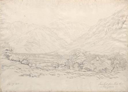 click to enlarge click to enlargePR1760.jpg ms, pencil at lower left, right:- "Sep 19 1808 / Bow Fell from Side House in Langdale" item:- Dove Cottage : B47 Image © see bottom of page |
|
|
|
||
| evidence:- | database:- Listed Buildings 2010 placename:- Side House Farm |
|
| source data:- | courtesy of English Heritage "SIDE HOUSE FARMHOUSE / / / LAKES / SOUTH LAKELAND / CUMBRIA / II / 452283 / NY2955106037" |
|
|
|
||
 Lakes Guides menu.