 Old Cumbria Gazetteer
 |
 |
|
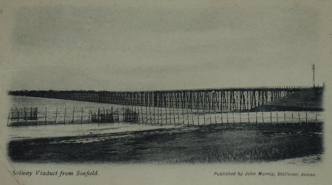
| Solway Viaduct, Bowness | ||
| Solway Viaduct | ||
| site name:- | Solway Junction Railway | |
| site name:- | Solway Firth | |
| civil parish:- | Bowness (formerly Cumberland) | |
| county:- | Cumbria | |
| locality type:- | railway viaduct | |
| locality type:- | viaduct | |
| coordinates:- | NY21196274 (etc) | |
| 1Km square:- | NY2162 | |
| 10Km square:- | NY26 | |
| country:- | Scotland | |
| locality type:- | railway viaduct | |
| locality type:- | viaduct | |
| coordinates:- | NY20646443 (etc) | |
| 1Km square:- | NY2064 | |
|
|
||
| evidence:- | old map:- OS County Series (Cmd 14 4) |
|
| source data:- | Maps, County Series maps of Great Britain, scales 6 and 25
inches to 1 mile, published by the Ordnance Survey, Southampton,
Hampshire, from about 1863 to 1948. shows the south pier and beginning of the viaduct "L.M. & S.R. / SOLWAY JUNCTION" |
|
|
|
||
 Click to enlarge BTN88.jpg 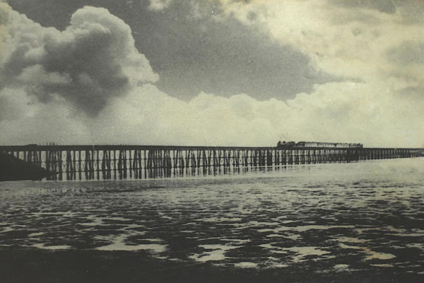 BTN91.jpg 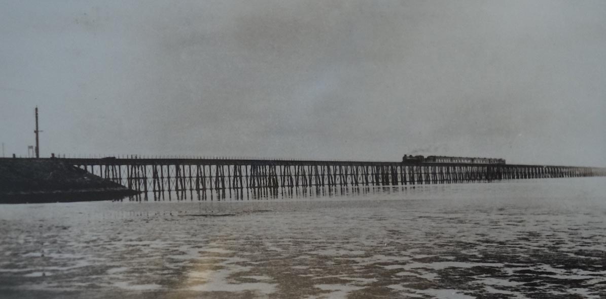 Click to enlarge CBM61.jpg courtesy of the Highland Laddie, Glasson. |
||
|
|
||
| hearsay:- |
||
| 182 spans of 30 feet; 1940 yards long. The viaduct suffered badly from the weather;
for example, February 1881, ice flows destroyed 37 spans which were not repaired till
1884. It was demolished in 1933. |
||
|
|
||
 Lakes Guides menu.