 Old Cumbria Gazetteer
 |
 |
|
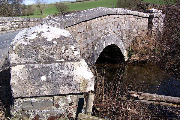
| St Sunday's Bridge, New Hutton | ||
| St Sunday's Bridge | ||
| site name:- | St Sunday's Beck | |
| civil parish:- | New Hutton (formerly Westmorland) | |
| civil parish:- | Old Hutton and Holmescales (formerly Westmorland) | |
| county:- | Cumbria | |
| locality type:- | bridge | |
| locality type:- | boundary stone | |
| locality type:- | parish boundary mark | |
| coordinates:- | SD55028962 | |
| 1Km square:- | SD5589 | |
| 10Km square:- | SD58 | |
|
|
||
 BLV18.jpg (taken 9.4.2006) 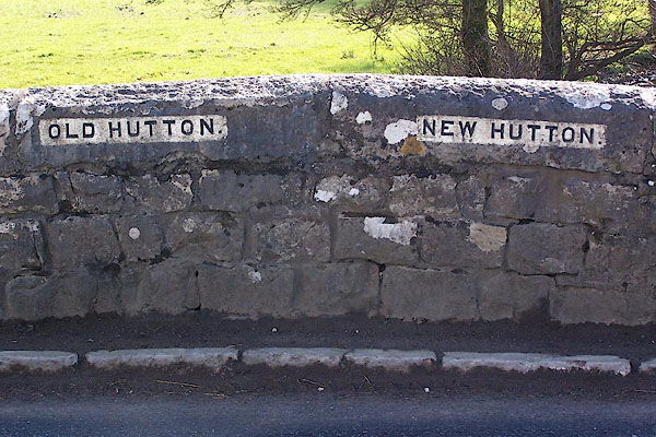 BLV19.jpg Boundary stones in parapet:- "OLD HUTTON / NEW HUTTON" (taken 9.4.2006) |
||
|
|
||
| evidence:- | old map:- OS County Series (Wmd 39 13) placename:- St Sunday's Bridge |
|
| source data:- | Maps, County Series maps of Great Britain, scales 6 and 25
inches to 1 mile, published by the Ordnance Survey, Southampton,
Hampshire, from about 1863 to 1948. |
|
|
|
||
 Lakes Guides menu.