 Old Cumbria Gazetteer
 |
 |
|
| included in:- |
 Derwent Water Derwent Water |
|
| viewpoint, Low Howray | ||
| locality:- | Low Howray | |
| civil parish:- | Keswick (formerly Cumberland) | |
| county:- | Cumbria | |
| locality type:- | viewpoint | |
| coordinates:- | NY25642380 (about) | |
| 1Km square:- | NY2523 | |
| 10Km square:- | NY22 | |
|
|
||
| evidence:- | old map:- Crosthwaite 1783-94 (Der) placename:- station, Derwent Water, Crosthwaite 2 |
|
| source data:- | Map, uncoloured engraving, An Accurate Map of the Matchless Lake
of Derwent, ie Derwent Water, scale about 3 inches to 1 mile, by
Peter Crosthwaite, Keswick, Cumberland, 1783, version published
1800.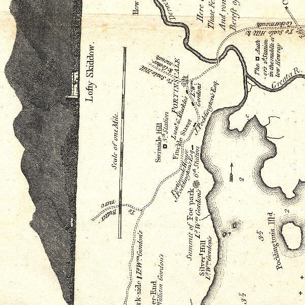 CT2NY22K.jpg "The author's 2d. Station in the middle of low Howray" item:- Armitt Library : 1959.191.3 Image © see bottom of page |
|
|
|
||
| indexing | ||
| person:- | map maker : Crosthwaite, Peter |
|
| place:- | Derwent Water | |
| date:- | 1783 |
|
| period:- | 18th century, late | |
| period:- | 1780s | |
| item:- | map; Accurate Map of the Matchless Lake of Derwent |
|
|
|
||
Lakes Guides menu.