 Old Cumbria Gazetteer
 |
 |
|
| Strawberry Wood, Lakes | ||
| Strawberry Wood | ||
| civil parish:- | Lakes (formerly Westmorland) | |
| county:- | Cumbria | |
| locality type:- | wood | |
| coordinates:- | NY38170354 (etc) | |
| 1Km square:- | NY3803 | |
| 10Km square:- | NY30 | |
|
|
||
| evidence:- | old map:- OS County Series (Wmd 26 10) placename:- Strawberry Wood |
|
| source data:- | Maps, County Series maps of Great Britain, scales 6 and 25
inches to 1 mile, published by the Ordnance Survey, Southampton,
Hampshire, from about 1863 to 1948. |
|
|
|
||
| evidence:- | perhaps old map:- Saxton 1579 |
|
| source data:- | Map, hand coloured engraving, Westmorlandiae et Cumberlandiae Comitatus ie Westmorland
and Cumberland, scale about 5 miles to 1 inch, by Christopher Saxton, London, engraved
by Augustinus Ryther, 1576, published 1579-1645.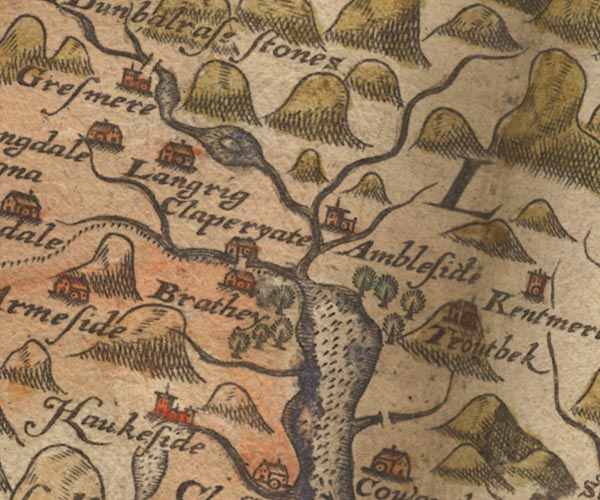 Sax9NY30.jpg Group of trees south of Ambleside. item:- private collection : 2 Image © see bottom of page |
|
|
|
||
| evidence:- | perhaps old map:- Speed 1611 (Wmd) |
|
| source data:- | Map, hand coloured engraving, The Countie Westmorland and
Kendale the Cheif Towne, scale about 2.5 miles to 1 inch, by
John Speed, 1610, published by George Humble, Popes Head Alley,
London, 1611-12.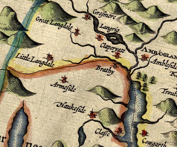 SP14NY30.jpg group of trees item:- Armitt Library : 2008.14.5 Image © see bottom of page |
|
|
|
||
 Lakes Guides menu.