 Old Cumbria Gazetteer
 |
 |
|
| Streethead, Hesket | ||
| Streethead | ||
| locality:- | Low Braithwaite | |
| civil parish:- | Hesket (formerly Cumberland) | |
| county:- | Cumbria | |
| locality type:- | buildings | |
| coordinates:- | NY42944243 | |
| 1Km square:- | NY4242 | |
| 10Km square:- | NY44 | |
|
|
||
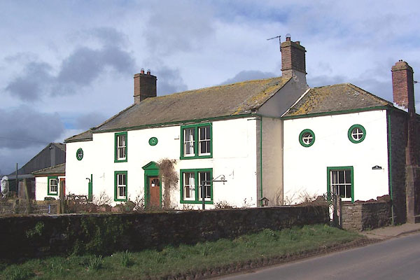 BNH79.jpg (taken 9.3.2007) 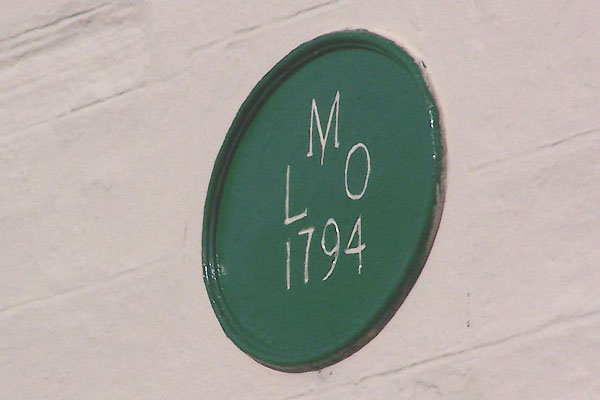 BNH80.jpg Date stone:- "M / L O / 1794" (taken 9.3.2007) |
||
|
|
||
| evidence:- | old map:- OS County Series (Cmd 39 5) placename:- Streethead |
|
| source data:- | Maps, County Series maps of Great Britain, scales 6 and 25
inches to 1 mile, published by the Ordnance Survey, Southampton,
Hampshire, from about 1863 to 1948. |
|
|
|
||
| evidence:- | database:- Listed Buildings 2010 placename:- Streethead item:- date stone (1794) |
|
| source data:- | courtesy of English Heritage "STREETHEAD / / / HESKET / EDEN / CUMBRIA / II / 73895 / NY4293442395" |
|
|
|
||
 Lakes Guides menu.