 Old Cumbria Gazetteer
 |
 |
|
| Toll Bar Cottage, Appleby-in-Westmorland | ||
| Toll Bar Cottage | ||
| Burrells Turn Pike | ||
| site name:- | road, Kendal to Appleby (?) | |
| civil parish:- | Appleby-in-Westmorland (formerly Westmorland) | |
| county:- | Cumbria | |
| locality type:- | toll gate (site) | |
| locality type:- | toll house (ex) | |
| locality type:- | buildings | |
| coordinates:- | NY68211915 | |
| 1Km square:- | NY6819 | |
| 10Km square:- | NY61 | |
|
|
||
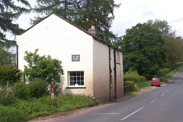 BME60.jpg (taken 30.5.2006) |
||
|
|
||
| evidence:- | old map:- OS County Series (Wmd 15 3) placename:- Burrells TP |
|
| source data:- | Maps, County Series maps of Great Britain, scales 6 and 25
inches to 1 mile, published by the Ordnance Survey, Southampton,
Hampshire, from about 1863 to 1948. "Burrels T.P." gate across road and a building |
|
|
|
||
 Lakes Guides menu.