 Old Cumbria Gazetteer
 |
 |
|
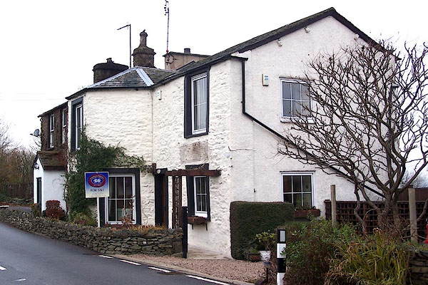
| Toll House, Scalthwaiterigg | ||
| Toll House | ||
| site name:- | road, Kendal to Tebay | |
| civil parish:- | Scalthwaiterigg (formerly Westmorland) | |
| county:- | Cumbria | |
| locality type:- | toll gate (site) | |
| locality type:- | toll house (ex) | |
| locality type:- | buildings | |
| coordinates:- | SD54399538 | |
| 1Km square:- | SD5495 | |
| 10Km square:- | SD59 | |
|
|
||
 BLL24.jpg (taken 9.12.2005) |
||
|
|
||
| evidence:- | old map:- OS County Series (Wmd 34 13) placename:- Scalthwaiterigg TP |
|
| source data:- | Maps, County Series maps of Great Britain, scales 6 and 25
inches to 1 mile, published by the Ordnance Survey, Southampton,
Hampshire, from about 1863 to 1948. "Scalthwaiterigg T.P." gate across road and a building |
|
|
|
||
 Lakes Guides menu.