 Old Cumbria Gazetteer
 |
 |
|
||
| Wolsty, Holme Low | ||||
| Wolsty | ||||
| civil parish:- | Holme Low (formerly Cumberland) | |||
| county:- | Cumbria | |||
| locality type:- | locality | |||
| locality type:- | buildings | |||
| coordinates:- | NY10435031 | |||
| 1Km square:- | NY1050 | |||
| 10Km square:- | NY15 | |||
|
|
||||
| evidence:- | old map:- OS County Series (Cmd 27 3) placename:- Wolsty |
|||
| source data:- | Maps, County Series maps of Great Britain, scales 6 and 25
inches to 1 mile, published by the Ordnance Survey, Southampton,
Hampshire, from about 1863 to 1948. |
|||
|
|
||||
| evidence:- | old map:- Sanson 1679 placename:- Wulsty |
|||
| source data:- | Map, hand coloured engraving, Ancien Royaume de Northumberland
aujourdhuy Provinces de Nort, ie the Ancient Kingdom of
Northumberland or the Northern Provinces, scale about 9.5 miles
to 1 inch, by Nicholas Sanson, Paris, France, 1679. click to enlarge click to enlargeSAN2Cm.jpg "Wulsty" circle, building and tower, flag; town? item:- Dove Cottage : 2007.38.15 Image © see bottom of page |
|||
|
|
||||
| evidence:- | old map:- Donald 1774 (Cmd) placename:- Wolsty |
|||
| source data:- | Map, hand coloured engraving, 3x2 sheets, The County of Cumberland, scale about 1
inch to 1 mile, by Thomas Donald, engraved and published by Joseph Hodskinson, 29
Arundel Street, Strand, London, 1774.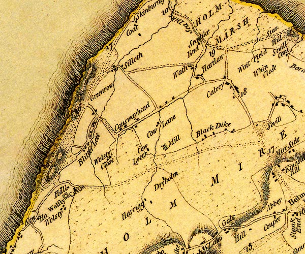 D4NY15SW.jpg "Wolsty" block or blocks, labelled in lowercase; a hamlet or just a house item:- Carlisle Library : Map 2 Image © Carlisle Library |
|||
|
|
||||
| evidence:- | old map:- Hall 1820 (Cmd) placename:- Wolsty |
|||
| source data:- | Map, hand coloured engraving, Cumberland, scale about 21 miles
to 1 inch, engraved by Sidney Hall, published by S Leigh, 18
Strand, London, 1820-31. click to enlarge click to enlargeHA14.jpg "Wolsty" circle, italic lowercase text; settlement item:- JandMN : 91 Image © see bottom of page |
|||
|
|
||||
| evidence:- | old map:- Ford 1839 map placename:- Wolsty |
|||
| source data:- | Map, uncoloured engraving, Map of the Lake District of
Cumberland, Westmoreland and Lancashire, scale about 3.5 miles
to 1 inch, published by Charles Thurnam, Carlisle, and by R
Groombridge, 5 Paternoster Row, London, 3rd edn 1843.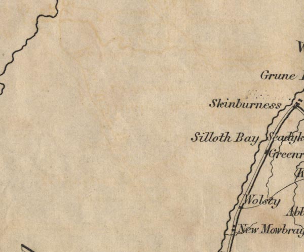 FD02NY05.jpg "Wolsty" item:- JandMN : 100.1 Image © see bottom of page |
|||
|
|
||||
| places:- |
|
|||
|
||||
|
||||
|
||||
|
||||
 Lakes Guides menu.