 Old Cumbria Gazetteer
 |
 |
|
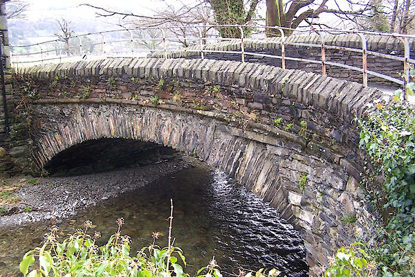
| Yewdale Bridge, Coniston | ||
| Yewdale Bridge | ||
| site name:- | Yewdale Beck | |
| civil parish:- | Coniston (formerly Lancashire) | |
| county:- | Cumbria | |
| locality type:- | bridge | |
| coordinates:- | SD30579763 | |
| 1Km square:- | SD3097 | |
| 10Km square:- | SD39 | |
|
|
||
 BLV46.jpg (taken 13.4.2006) 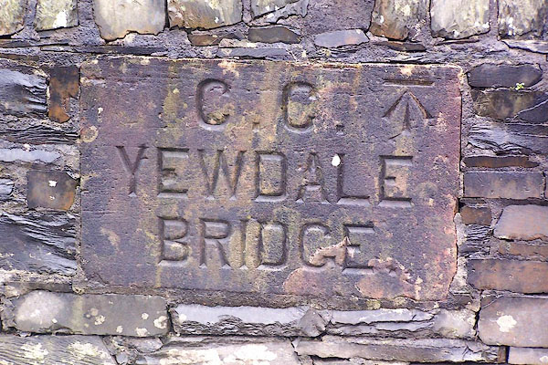 BLV47.jpg Stone on parapet:- "C.C. YEWDALE BRIDGE" and a cut bench mark. (taken 13.4.2006) |
||
|
|
||
| evidence:- | old map:- Crosthwaite 1783-94 (Con) |
|
| source data:- | Map, uncoloured engraving, An Accurate Map of Coniston Lake,
scale about 3 inches to 1 mile, by Peter Crosthwaite, Keswick,
Cumberland, 1788, version published 1809.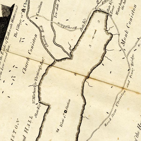 CTESD39D.jpg road across the stream item:- JandMN : 182.5 Image © see bottom of page |
|
|
|
||
 Lakes Guides menu.