 Old Cumbria Gazetteer
 |
 |
|
| fingerpost, Cowgill (2) | ||
| locality:- | Lea Yeat | |
| locality:- | Cowgill | |
| civil parish:- | Dent (formerly Yorkshire) | |
| county:- | Cumbria | |
| locality type:- | fingerpost | |
| locality type:- | placename sign | |
| coordinates:- | SD76068692 | |
| 1Km square:- | SD7686 | |
| 10Km square:- | SD78 | |
|
|
||
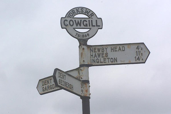 BMG59.jpg (taken 16.6.2006) 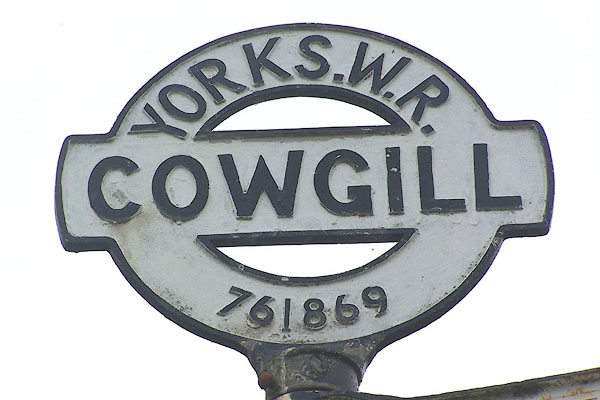 BMG60.jpg The fingerpost was erected by Yorkshire West Riding; the six figure national grid reference was included as an experiment, on behalf of the Ministry of Transport, initiated in 1930. (One other county, Dorset, was aksed to do this; and another, Berkshire, copied the idea.) (taken 16.6.2006) |
||
|
|
||
 Lakes Guides menu.