 Old Cumbria Gazetteer
 |
 |
|
| Ashgill Bridge, Alston Moor | ||
| Ashgill Bridge | ||
| site name:- | Ash Gill | |
| locality:- | Ashgill | |
| civil parish:- | Alston Moor (formerly Cumberland) | |
| county:- | Cumbria | |
| locality type:- | bridge | |
| coordinates:- | NY75904048 | |
| 1Km square:- | NY7540 | |
| 10Km square:- | NY74 | |
|
|
||
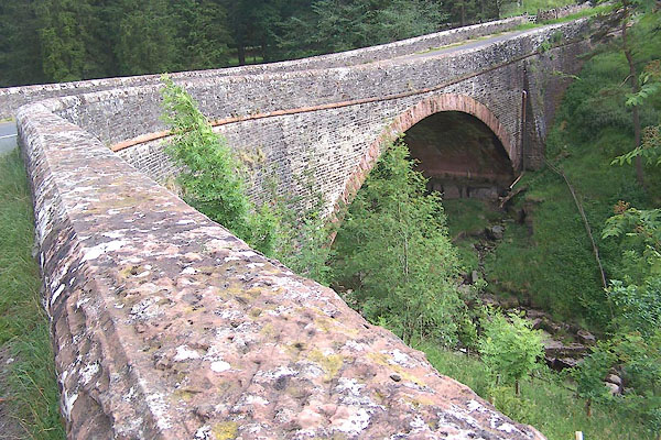 BMI51.jpg (taken 7.7.2006) 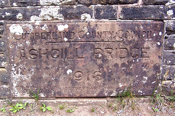 BMI52.jpg Plaque:- "CUMBERLAND COUNTY COUNCIL / ASHGILL BRIDGE / 1916 / WILLIAM FINCH COUNTY SURVEYORY &[BRIDGE] MASTER" (taken 7.7.2006) |
||
|
|
||
| evidence:- | old map:- Bell 1892 placename:- Ashgill Bridge |
|
| source data:- | Map, colour lithograph, Road Map of Cumberland, by George Joseph
Bell, scale about 2.5 miles to 1 inch, printed by Charles
Thurnam and Sons, Carlisle, Cumberland, 1892.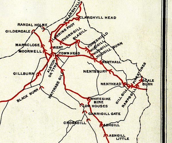 BEL9NY74.jpg "ASHGILL" bridge symbol Road map of Cumberland showing County Bridges item:- Carlisle Library : Map 38 Image © Carlisle Library |
|
|
|
||
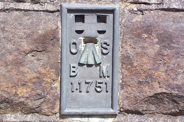 BMI53.jpg Flush bracket bench mark 11751. (taken 7.7.2006) |
||
|
|
||
 Lakes Guides menu.