 Old Cumbria Gazetteer
 |
 |
|
| milestone, Alston Moor (13) | ||
| site name:- | road, Alston to Barnard Castle | |
| civil parish:- | Alston Moor (formerly Cumberland) | |
| county:- | Cumbria | |
| locality type:- | milestone | |
| coordinates:- | NY72524519 | |
| 1Km square:- | NY7245 | |
| 10Km square:- | NY74 | |
|
|
||
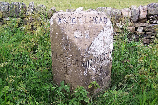 BMI63.jpg Inscribed stone:- "ALSTON 1 / ASHGILLHEAD [3]½/ MIDDLETON 21" (taken 7.7.2006) |
||
|
|
||
| evidence:- | database:- Listed Buildings 2010 |
|
| source data:- | courtesy of English Heritage "MILESTONE TO NORTH EAST OF HIGH ANNAT WALLS / / B6277 / ALSTON MOOR / EDEN / CUMBRIA / II / 73099 / NY7252245191" |
|
| source data:- | courtesy of English Heritage "Milestone, probably C19 for Alston Turnpike Trust. Single stone c2 1/2 ft high with 2 angled front faces and angled top; painted white with carved sans-serif lettering picked out in black: ASHGILLHEAD 9 1/2 to top, ALSTON 1 to left, and MIDDLETON 21 to right." |
|
|
|
||
 Lakes Guides menu.