 Old Cumbria Gazetteer
 |
 |
|
| milestone, Alston Moor (6) | ||
| site name:- | road, Alston to Barnard Castle | |
| civil parish:- | Alston Moor (formerly Cumberland) | |
| county:- | Cumbria | |
| locality type:- | milestone | |
| coordinates:- | NY72914366 | |
| 1Km square:- | NY7243 | |
| 10Km square:- | NY74 | |
|
|
||
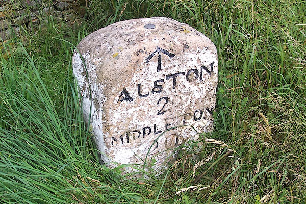 BMI60.jpg Inscribed stone:- "ALSTON 2 / MIDDLETON 20" and a rivet bench mark. (taken 7.7.2006) 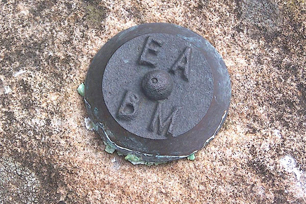 BMI61.jpg Bench mark stud. (taken 7.7.2006) |
||
|
|
||
| evidence:- | old map:- OS County Series (Cmd 42 1) |
|
| source data:- | Maps, County Series maps of Great Britain, scales 6 and 25
inches to 1 mile, published by the Ordnance Survey, Southampton,
Hampshire, from about 1863 to 1948. "Alston ..2 Middleton .. 20 M.S." |
|
|
|
||
| evidence:- | database:- Listed Buildings 2010 |
|
| source data:- | courtesy of English Heritage "MILESTONE TO WEST OF RISE HEAD / / B6277 / ALSTON MOOR / EDEN / CUMBRIA / II / 73100 / NY7290243668" |
|
| source data:- | courtesy of English Heritage "Milestone, early C19 for Alston Turnpike Trust. Single stone c2 ft high by c1 1/2 wide with elliptical top; painted white with carved Roman lettering on front face picked out in black: ALSTON 2, MIDDLETON 20. Benchmark added at top." |
|
|
|
||
 Lakes Guides menu.