 Old Cumbria Gazetteer
 |
 |
|
| milestone, Alston Moor (9) | ||
| site name:- | road, Alston to Barnard Castle | |
| civil parish:- | Alston Moor (formerly Cumberland) | |
| county:- | Cumbria | |
| locality type:- | milestone | |
| coordinates:- | NY75774057 | |
| 1Km square:- | NY7540 | |
| 10Km square:- | NY74 | |
|
|
||
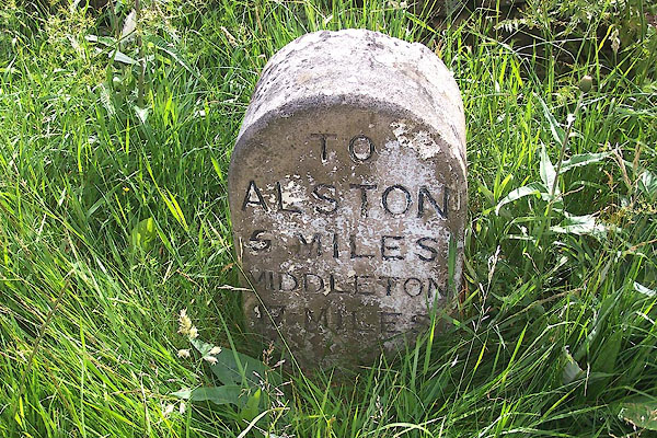 BMI57.jpg Inscribed stone:- "TO ALSTON 5 MILES / MIDDLETON 17 MILES" (taken 7.7.2006) |
||
|
|
||
| evidence:- | database:- Listed Buildings 2010 |
|
| source data:- | courtesy of English Heritage "MILESTONE TO EAST OF ASHGILLSIDE / / B6277 / ALSTON MOOR / EDEN / CUMBRIA / II / 73103 / NY7576340584" |
|
| source data:- | courtesy of English Heritage "Milestone, early C19 for Alston Turnpike Trust. Single stone c2 ft high by 1 1/2 ft wide with semicircular top; painted white with carved sans-serif lettering on front face picked out in black: TO ALSTON 5 MILES, MIDDLETON 17 MILES." |
|
|
|
||
 Lakes Guides menu.