 Old Cumbria Gazetteer
 |
 |
|
| Wellington Pit, Whitehaven | ||
| Wellington Pit | ||
| site name:- | Whitehaven Coalfield | |
| locality:- | Whitehaven | |
| civil parish:- | Whitehaven (formerly Cumberland) | |
| county:- | Cumbria | |
| locality type:- | coal mine | |
| locality type:- | mine | |
| coordinates:- | NX96801820 (etc) | |
| 1Km square:- | NX9618 | |
| 10Km square:- | NX91 | |
|
|
||
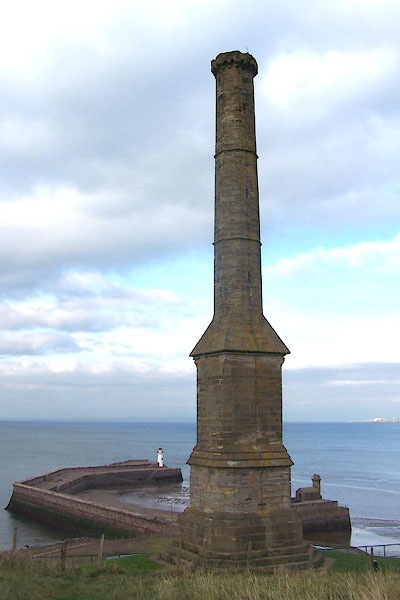 BJY04.jpg Chimney, prominent above the harbour; known as The Candle, served the Wellington Pit. (taken 14.10.2005) |
||
|
|
||
| evidence:- | old map:- OS County Series (Cmd 67 2) placename:- Wellington Pit |
|
| source data:- | Maps, County Series maps of Great Britain, scales 6 and 25
inches to 1 mile, published by the Ordnance Survey, Southampton,
Hampshire, from about 1863 to 1948. "Wellington Pit (Coal)" |
|
|
|
||
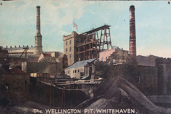 BML03.jpg About 1910. Courtesy of Keswick Mining Museum. |
||
|
|
||
 Lakes Guides menu.