 Old Cumbria Gazetteer
 |
 |
|
| boundary stone, Hutton Roof | ||
| civil parish:- | Hutton Roof (formerly Westmorland) | |
| county:- | Cumbria | |
| locality type:- | boundary stone | |
| locality type:- | county boundary mark | |
| coordinates:- | SD57807702 | |
| 1Km square:- | SD5777 | |
| 10Km square:- | SD57 | |
| county:- | Lancashire | |
| current boundary | ||
| locality:- | Cumbria boundary | |
| old boundary | ||
| locality:- | Westmorland boundary | |
| locality:- | Lancashire boundary | |
|
|
||
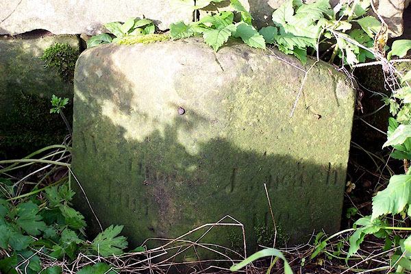 BMX99.jpg Inscribed stone:- "Westmorland / Lancashire" (taken 29.10.2006) |
||
|
|
||
 Lakes Guides menu.