 Old Cumbria Gazetteer
 |
 |
|
| Foul Town, Northumberland | ||
| Foul Town | ||
| county:- | Northumberland | |
| locality type:- | buildings | |
| coordinates:- | NY646661 | |
| 1Km square:- | NY6466 | |
| 10Km square:- | NY66 | |
| references:- | OS County Series |
|
|
|
||
| evidence:- | possibly old map:- Ogilby 1675 (plate 86) placename:- Furley |
|
| source data:- | Road strip map, uncoloured engraving, the Road from Tinmouth ...
to Carlisle, scale about 1 inch to 1 mile, by John Ogilby,
London, 1675.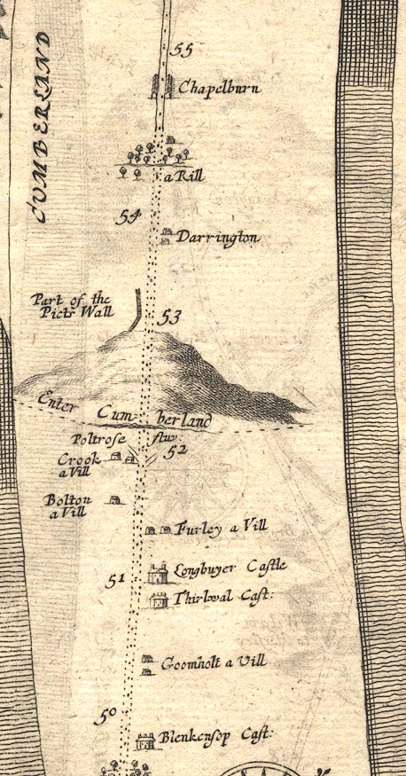 OG86m050.jpg In mile 51, Northumberland. "Furley a Vill" houses on the right of the road. item:- JandMN : 73 Image © see bottom of page |
|
|
|
||
 Lakes Guides menu.