 Old Cumbria Gazetteer
 |
 |
|
| Holy Well, Nicholforest | ||
| Holy Well | ||
| Catlowdy Holy Well | ||
| locality:- | Rae Burn (near) | |
| locality:- | Catlowdy | |
| civil parish:- | Nicholforest (formerly Cumberland) | |
| county:- | Cumbria | |
| locality type:- | spring | |
| locality type:- | well | |
| locality type:- | holy well | |
| coordinates:- | NY46387551 | |
| 1Km square:- | NY4675 | |
| 10Km square:- | NY47 | |
|
|
||
| evidence:- | old map:- OS County Series (Cmd 7 2) placename:- Holy Well item:- sulphurous spring |
|
| source data:- | Maps, County Series maps of Great Britain, scales 6 and 25
inches to 1 mile, published by the Ordnance Survey, Southampton,
Hampshire, from about 1863 to 1948. "Holy Well (Sulphurous)" |
|
|
|
||
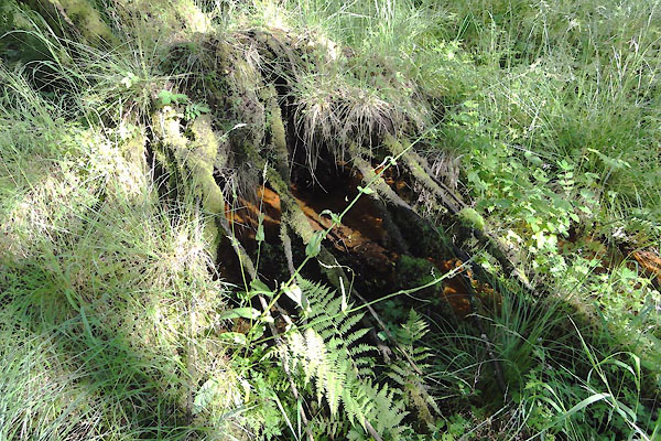 BVJ87.jpg courtesy of Ed Henderson |
||
| The well near Catlowdy is a chaleybeate spring, dominated by iron oxides. |
||
|
|
||
| observation:- |
Holy and traditional or not, this seems to be completely inaccessible. |
|
|
|
||
 Lakes Guides menu.