 Old Cumbria Gazetteer
 |
 |
|
| Langley Toll Cottage, Corby Hill | ||
| Langley Toll Cottage | ||
| site name:- | road, Carlisle to Brampton S | |
| locality:- | Corby Hill | |
| civil parish:- | Hayton (formerly Cumberland) | |
| county:- | Cumbria | |
| locality type:- | toll gate (site) | |
| locality type:- | toll house (ex, and altered!) | |
| coordinates:- | NY47935711 | |
| 1Km square:- | NY4757 | |
| 10Km square:- | NY45 | |
|
|
||
| MN photo:- |
The present building doesn't seem to owe much to a toll house on this spot. |
|
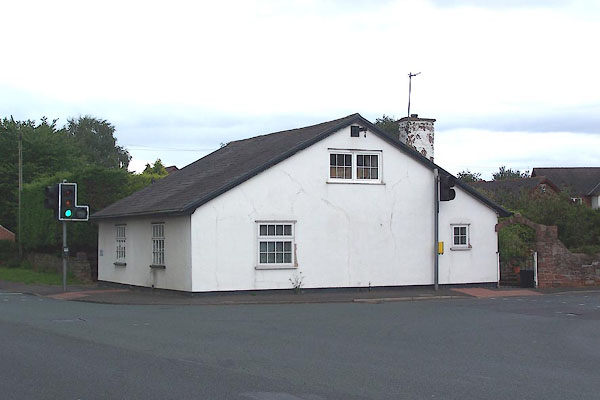 BMM86.jpg (taken 11.8.2006) |
||
|
|
||
| evidence:- | old map:- OS County Series (Cmd 24) |
|
| source data:- | Maps, County Series maps of Great Britain, scales 6 and 25
inches to 1 mile, published by the Ordnance Survey, Southampton,
Hampshire, from about 1863 to 1948. "T.P." at Corby Hill line across road |
|
|
|
||
 Lakes Guides menu.