 Old Cumbria Gazetteer
 |
 |
|
| Lowhouses Bridge, Low Houses | ||
| Lowhouses Bridge | ||
| site name:- | Garrigill Burn | |
| locality:- | Beldy | |
| locality:- | Garrigill | |
| civil parish:- | Alston Moor (formerly Cumberland) | |
| county:- | Cumbria | |
| locality type:- | buildings | |
| coordinates:- | NY74264201 | |
| 1Km square:- | NY7442 | |
| 10Km square:- | NY74 | |
|
|
||
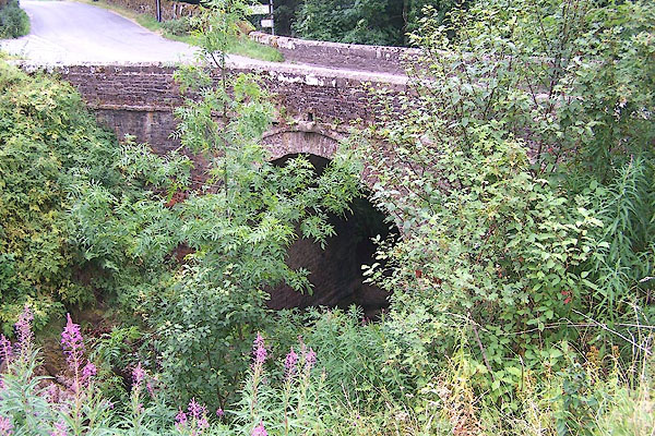 BML65.jpg (taken 29.7.2006) 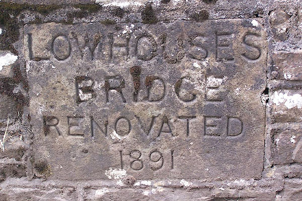 BML66.jpg Inscribed stone in parapet:- "LOWHOUSES BRIDGE RENOVATED 1891" (taken 29.7.2006) |
||
|
|
||
| evidence:- | old map:- Bell 1892 placename:- Low Houses Bridge |
|
| source data:- | Map, colour lithograph, Road Map of Cumberland, by George Joseph
Bell, scale about 2.5 miles to 1 inch, printed by Charles
Thurnam and Sons, Carlisle, Cumberland, 1892.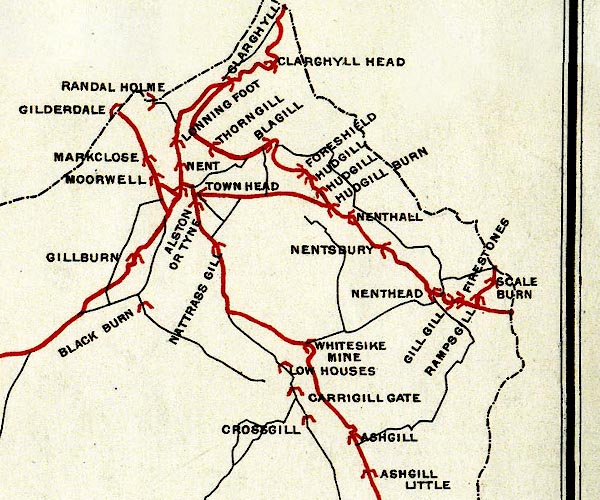 BEL9NY74.jpg "LOW HOUSES" bridge symbol Road map of Cumberland showing County Bridges item:- Carlisle Library : Map 38 Image © Carlisle Library |
|
|
|
||
 Lakes Guides menu.