 Old Cumbria Gazetteer
 |
 |
|
| Rydal Old Hall, Rydal | ||
| Rydal Old Hall | ||
| locality:- | Old Hall Hill | |
| locality:- | Rydal | |
| civil parish:- | Lakes (formerly Westmorland) | |
| county:- | Cumbria | |
| locality type:- | buildings | |
| coordinates:- | NY36930552 (about) | |
| 1Km square:- | NY3605 | |
| 10Km square:- | NY30 | |
|
|
||
| evidence:- | perhaps old map:- Ogilby 1675 (plate 96) placename:- Hall, The |
|
| source data:- | Road strip map, hand coloured engraving, the Road from Kendal to
Cockermouth, and the Road from Egremond to Carlisle, scale about
1 inch to 1 mile, by John Ogilby, London, 1675.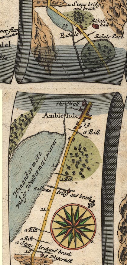 OG96m010.jpg In mile 13, Westmoreland. "the Hall" large house on the left of the road. item:- JandMN : 22 Image © see bottom of page |
|
|
|
||
| evidence:- | old map:- Bowen 1720 (plate 260) placename:- Hall, The |
|
| source data:- | Road strip map, uncoloured engraving, pl.260, The Road from
Kendal to Cockermouth, scale about 2 miles to 1 inch, with
sections in Westmorland and Cumberland, published by Emanuel
Bowen, St Katherines, London, 1720.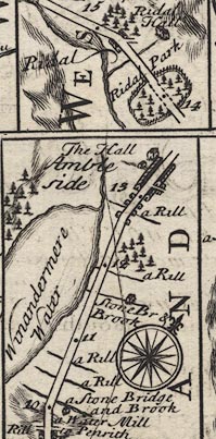 B260m10.jpg At mile 13½. item:- private collection : 1.260 Image © see bottom of page |
|
|
|
||
| notes:- |
site of hall |
|
| Perriam, D R &Robinson, J: 1998: Medieval Fortified Buildings of Cumbria: CWAAS::
ISBN 1 873124 23 6; illustration |
||
|
|
||
 Lakes Guides menu.