 Old Cumbria Gazetteer
 |
 |
|
| Bees Nest, Casterton | ||
| Bees Nest | ||
| Street:- | Gateheads Brow | |
| locality:- | High Casterton | |
| civil parish:- | Casterton (formerly Westmorland) | |
| county:- | Cumbria | |
| locality type:- | buildings | |
| coordinates:- | SD62717924 | |
| 1Km square:- | SD6279 | |
| 10Km square:- | SD67 | |
|
|
||
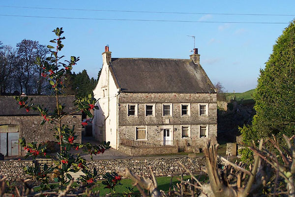 BNB38.jpg (taken 1.12.2006) |
||
|
|
||
| evidence:- | old map:- OS County Series (Wmd 48 5) placename:- Bees Nest |
|
| source data:- | Maps, County Series maps of Great Britain, scales 6 and 25
inches to 1 mile, published by the Ordnance Survey, Southampton,
Hampshire, from about 1863 to 1948. |
|
|
|
||
| evidence:- | database:- Listed Buildings 2010 placename:- Bee Nest Farm item:- date stone (1723) |
|
| source data:- | courtesy of English Heritage "BEE NEST FARMHOUSE / / GATEHEADS BROW / CASTERTON / SOUTH LAKELAND / CUMBRIA / II / 75621 / SD6271279242" |
|
|
|
||
| evidence:- | database:- Listed Buildings 2010 |
|
| source data:- | courtesy of English Heritage "BARN TO WEST OF BEE NEST FARMHOUSE / / GATEHEADS BROW / CASTERTON / SOUTH LAKELAND / CUMBRIA / II / 75622 / SD6268879235" |
|
|
|
||
 Lakes Guides menu.