 Old Cumbria Gazetteer
 |
 |
|
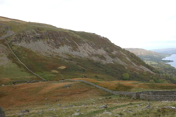
| Glencoyne Brow, Matterdale | ||
| Glencoyne Brow | ||
| locality:- | Glencoyne | |
| civil parish:- | Matterdale (formerly Cumberland) | |
| county:- | Cumbria | |
| locality type:- | hill | |
| locality type:- | fell | |
| coordinates:- | NY377190 (etc) | |
| 1Km square:- | NY3719 | |
| 10Km square:- | NY31 | |
|
|
||
 CED73.jpg (taken 20.10.2015) 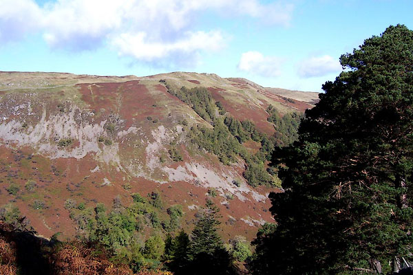 BOH39.jpg (taken 17.10.2007) |
||
|
|
||
| evidence:- | outline view:- Otley 1823 (4th edn 1830) placename:- Glencoin Fell |
|
| source data:- | Print, engraving, outline view, Mountains of Patterdale as seen from the Slate Quarry
on Place Fell, published by Jonathan Otley, Keswick, Cumberland et al, 1830.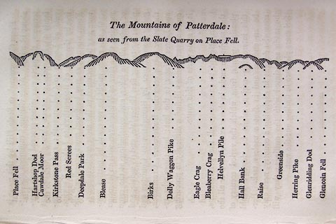 click to enlarge click to enlargeO75E10.jpg p.137 in A Concise Description of the English Lakes, by Jonathan Otley, 4th edition, 1830. "The Mountains of Patterdale: / as seen from the Slate Quarry on Place Fell." "Place Fell / Hartshop Dod / Cawdale Moor / Kirkstone Pass / Red Screes / Deepdale Park / Blease / Birks / Dolly Waggon Pike / Eagle Crag / Bleaberry Pike / Helvellyn Pile / Hall Bank / Raise / Greenside / Herring Pike / Glenridding Dod / Glencoin Fell" item:- Armitt Library : A1175.10 Image © see bottom of page |
|
|
|
||
| evidence:- | probably outline view:- Otley 1823 (5th edn 1834) placename:- Glencoin Fell |
|
| source data:- | Print, woodcut outline view, The Mountains of Patterdale, by
Jonathan Otley, Keswick, Cumberland, 1830.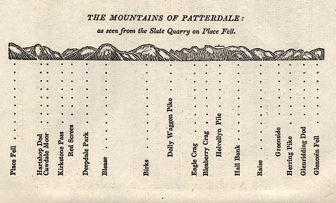 click to enlarge click to enlargeOT2E02.jpg Printed on p.11 of A Concise Description of the English Lakes, by Jonathan Otley, 5th edition, 1834. "THE MOUNTAINS OF PATTERDALE: as seen from the Slate Quarry on Place Fell." "Place Fell / Hartsop Dod / Cawdale Moor / Kirkstone Pass / Red Screes / Deepdale Park / Blease / Birks / Dolly Waggon Pike / Eagle Crag / Bleaberry Crag / Helvellyn Pile / Hall Bank / Raise / Greenside / Herring Pike / Glenridding Dod / Glencoin Fell" item:- JandMN : 48.3 Image © see bottom of page |
|
|
|
||
 Lakes Guides menu.