 Old Cumbria Gazetteer
 |
 |
|
| boundary stone, Seathwaite (2) | ||
| locality:- | Seathwaite | |
| civil parish:- | Borrowdale (formerly Cumberland) | |
| county:- | Cumbria | |
| locality type:- | boundary stone | |
| coordinates:- | NY23351230 | |
| 1Km square:- | NY2312 | |
| 10Km square:- | NY21 | |
| SummaryText:- | Marking the boundary of the black lead mine? | |
|
|
||
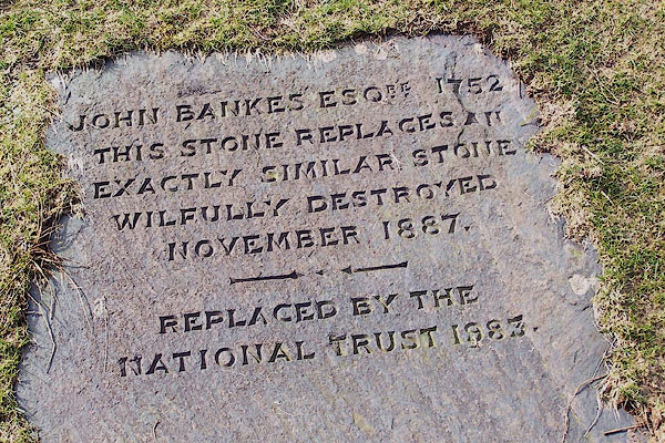 BNG39.jpg "JOHN BANKES ESQRE. 1752 ..." Not at exactly similar, if it were possible to be such, so it's not clear what was here. (taken 26.2.2007) |
||
|
|
||
 Lakes Guides menu.