 Old Cumbria Gazetteer
 |
 |
|
| Galloping Horse Inn, Harrington | ||
| Galloping Horse Inn | ||
| locality:- | Kilngreen | |
| locality:- | High Harrington | |
| civil parish:- | Workington (formerly Cumberland) | |
| county:- | Cumbria | |
| locality type:- | inn | |
| coordinates:- | NY00252545 | |
| 1Km square:- | NY0025 | |
| 10Km square:- | NY02 | |
|
|
||
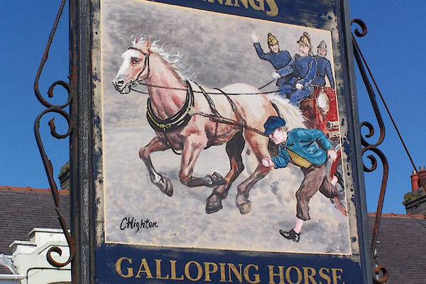 BNQ20.jpg A manual fire engine in a hurry, painted by C Highton (taken 14.5.2007) 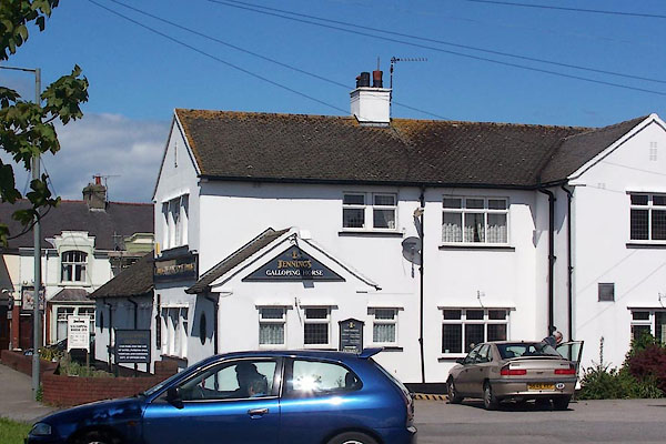 BNQ19.jpg (taken 14.5.2007) |
||
|
|
||
| evidence:- | old map:- OS County Series (Cmd 61 3) placename:- Galloping Horse |
|
| source data:- | Maps, County Series maps of Great Britain, scales 6 and 25
inches to 1 mile, published by the Ordnance Survey, Southampton,
Hampshire, from about 1863 to 1948. |
|
|
|
||
 Lakes Guides menu.