 Old Cumbria Gazetteer
 |
 |
|
| Hawk Rigg, Coniston | ||
| Hawk Rigg | ||
| civil parish:- | Coniston (formerly Lancashire) | |
| county:- | Cumbria | |
| locality type:- | locality | |
| locality type:- | rocks (?) | |
| coordinates:- | NY299016 | |
| 1Km square:- | NY2901 | |
| 10Km square:- | NY20 | |
|
|
||
| evidence:- | just possibly outline view:- Otley 1823 (8th edn 1849) placename:- Great Oukrigg |
|
| source data:- | Engraving, outline view of mountains, Coniston Water from near Bank Ground, drawn
by T Binns, engraved by O Jewitt, opposite p.8 of A Descriptive Guide of the English
Lakes, by Jonathan Otley, 8th edition, 1849.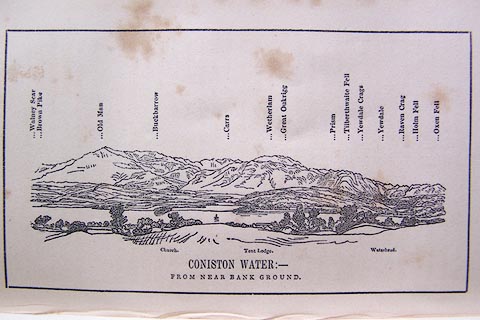 click to enlarge click to enlargeO80E05.jpg item:- Armitt Library : A1180.6 Image © see bottom of page |
|
|
|
||
 Lakes Guides menu.