 Old Cumbria Gazetteer
 |
 |
|
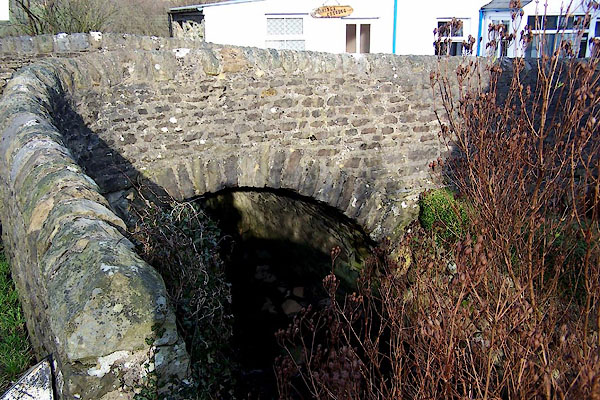
| Oliver Bridge, Gawthrop | ||
| Oliver Bridge | ||
| site name:- | Oliver Gill | |
| locality:- | Gawthrop | |
| civil parish:- | Dent (formerly Yorkshire) | |
| county:- | Cumbria | |
| locality type:- | bridge | |
| coordinates:- | SD69258738 | |
| 1Km square:- | SD6987 | |
| 10Km square:- | SD68 | |
|
|
||
 BNH65.jpg (taken 2.3.2007) |
||
|
|
||
| evidence:- | old map:- OS County Series (Yrk 64 13) placename:- Oliver Bridge |
|
| source data:- | Maps, County Series maps of Great Britain, scales 6 and 25
inches to 1 mile, published by the Ordnance Survey, Southampton,
Hampshire, from about 1863 to 1948. |
|
|
|
||
| evidence:- | database:- Listed Buildings 2010 placename:- Oliver Bridge |
|
| source data:- | courtesy of English Heritage "OLIVER BRIDGE / / / DENT / SOUTH LAKELAND / CUMBRIA / II / 484406 / SD6925887391" |
|
| source data:- | courtesy of English Heritage "Also known as: Haycote Bridge GAWTHROP." "Public road bridge over Oliver Beck. Probably C17. Coursed rubble. Small almost-semicircular arch with rubble voussoirs; parapets with rounded coping, the west end of the south parapet curved round to the south. The bridge forms a central feature of the hamlet of Gawthrop." |
|
|
|
||
 Lakes Guides menu.