 Old Cumbria Gazetteer
 |
 |
|
| trig point, SD2304294451 | ||
| site name:- | Caw | |
| civil parish:- | Dunnerdale-with-Seathwaite (formerly Lancashire) | |
| county:- | Cumbria | |
| locality type:- | trig point (pillar) | |
| coordinates:- | SD2304294451 | |
| 1Km square:- | SD2394 | |
| 10Km square:- | SD29 | |
| altitude:- | 1736 feet | |
| altitude:- | 529.1m | |
| references:- | OS website |
|
|
|
||
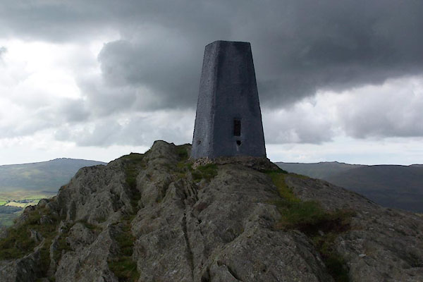 BTL72.jpg (taken 25.8.2010) 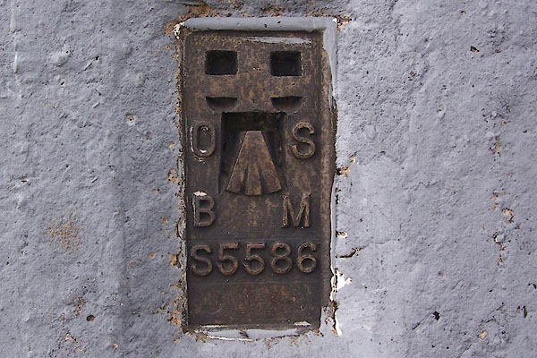 BTL73.jpg Flush bracket bench mark. (taken 25.8.2010) |
||
|
|
||
 Lakes Guides menu.