 Old Cumbria Gazetteer
 |
 |
|
| trig point, SD7384981414 | ||
| site name:- | Little Whernside | |
| locality:- | Whernside | |
| locality:- | Whernside Millennium Viewpoint | |
| civil parish:- | Dent (formerly Yorkshire) | |
| county:- | Cumbria | |
| locality type:- | trig point (pillar) | |
| locality type:- | millennium project | |
| coordinates:- | SD7384981414 | |
| 1Km square:- | SD7381 | |
| 10Km square:- | SD78 | |
| altitude:- | 2416 feet | |
| altitude:- | 736.3m | |
| references:- | OS website |
|
|
|
||
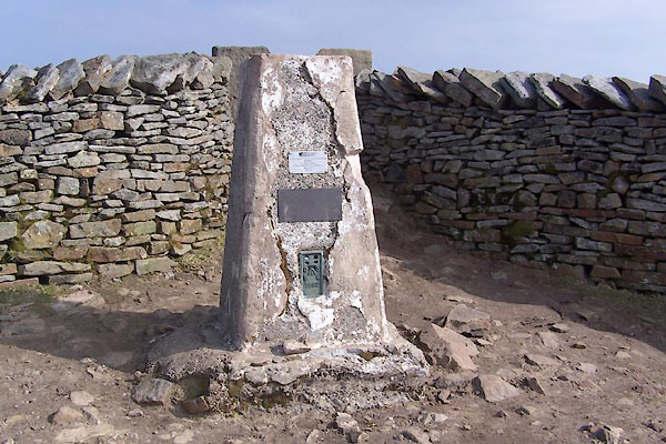 BUG36.jpg (taken 24.3.2011) 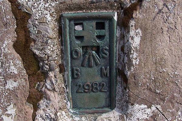 BUG37.jpg Flush bracket bench mark:- "S2982" (taken 24.3.2011) 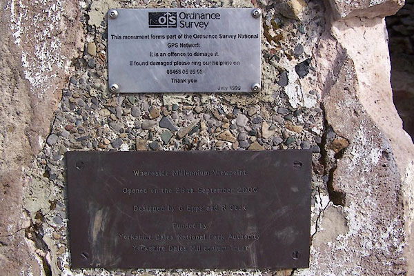 BUG38.jpg Notices, OS National GPS Network and Whernside Millennium Viewpoint. (taken 24.3.2011) |
||
|
|
||
 Lakes Guides menu.