 Old Cumbria Gazetteer
 |
 |
|
|||||||||
goto  tenKm squares tenKm squares |
|||||||||||
| NY31 | |||||||||||
| civil parish:- | Lakes (formerly Westmorland) | ||||||||||
| civil parish:- | Matterdale (formerly Cumberland) | ||||||||||
| civil parish:- | Martindale (formerly Westmorland) | ||||||||||
| civil parish:- | St John's Castlerigg and Wythburn (formerly Cumberland) | ||||||||||
| civil parish:- | Patterdale (formerly Westmorland) | ||||||||||
| county:- | Cumbria | ||||||||||
| locality type:- | 10Km square | ||||||||||
| 10Km square:- | NY31 | ||||||||||
|
|
|||||||||||
| adjacent:- |
|
||||||||||
| 1Km squares:- | 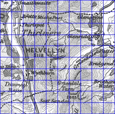 click on an active square click on an active square |
||||||||||
|
|
|||||||||||
| evidence:- | old map:- OS 1946 Quarter Inch |
||||||||||
| source data:- | Maps, sheet 1, The Border, and sheet 2, England, North Central,
in the Quarter Inch Map of Great Britain series, 4th edn with
National Grid in yards, scale 4 miles to 1 inch, published by
the Ordnance Survey, Southampton, Hampshire, 1946.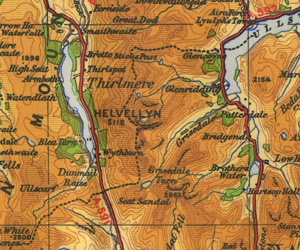 OS24NY31.jpg item:- JandMN : 103 Image © see bottom of page |
||||||||||
|
|
|||||||||||
| evidence:- | old map:- Saxton 1579 |
||||||||||
| source data:- | Map, hand coloured engraving, Westmorlandiae et Cumberlandiae Comitatus ie Westmorland
and Cumberland, scale about 5 miles to 1 inch, by Christopher Saxton, London, engraved
by Augustinus Ryther, 1576, published 1579-1645.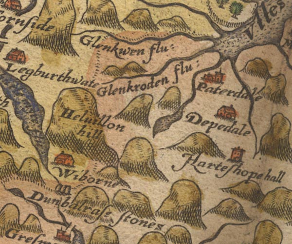 Sax9NY31.jpg Approximate 10Km square, plus overlaps. item:- private collection : 2 Image © see bottom of page |
||||||||||
|
|
|||||||||||
| evidence:- | old map:- Speed 1611 (Cmd) |
||||||||||
| source data:- | Map, hand coloured engraving, Cumberland and the Ancient Citie
Carlile Described, scale about 4 miles to 1 inch, by John Speed,
1610, published by J Sudbury and George Humble, Popes Head
Alley, London, 1611-12.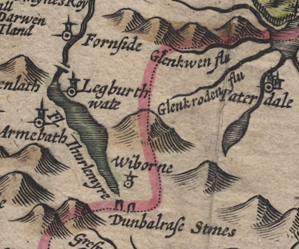 SP11NY31.jpg Approximate 10Km square plus overlaps item:- private collection : 16 Image © see bottom of page |
||||||||||
|
|
|||||||||||
| evidence:- | old map:- Speed 1611 (Wmd) |
||||||||||
| source data:- | Map, hand coloured engraving, The Countie Westmorland and
Kendale the Cheif Towne, scale about 2.5 miles to 1 inch, by
John Speed, 1610, published by George Humble, Popes Head Alley,
London, 1611-12.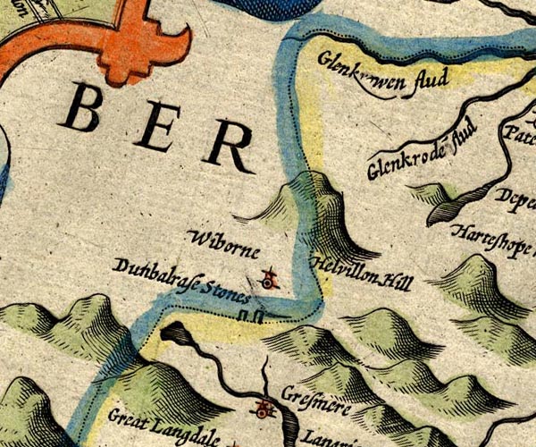 SP14NY31.jpg Approximate 10Km square plus overlaps item:- Armitt Library : 2008.14.5 Image © see bottom of page |
||||||||||
|
|
|||||||||||
| evidence:- | old map:- Jansson 1646 |
||||||||||
| source data:- | Map, hand coloured engraving, Cumbria and Westmoria, ie
Cumberland and Westmorland, scale about 3.5 miles to 1 inch, by
John Jansson, Amsterdam, Netherlands, 1646.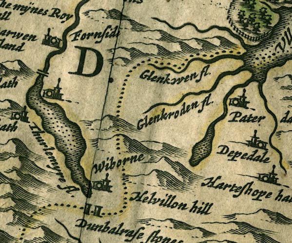 JAN3NY31.jpg Approximate 10Km square, plus overlaps. item:- JandMN : 88 Image © see bottom of page |
||||||||||
|
|
|||||||||||
| evidence:- | old map:- Morden 1695 (Cmd) |
||||||||||
| source data:- | Map, uncoloured engraving, Cumberland, scale about 4 miles to 1
inch, by Robert Morden, 1695, published by Abel Swale, the
Unicorn, St Paul's Churchyard, Awnsham, and John Churchill, the
Black Swan, Paternoster Row, London, 1695-1715.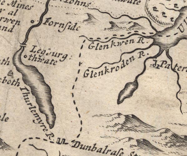 MD12NY31.jpg Approximate 10Km square, plus overlaps item:- JandMN : 90 Image © see bottom of page |
||||||||||
|
|
|||||||||||
| evidence:- | old map:- Morden 1695 (Wmd) |
||||||||||
| source data:- | Map, hand coloured engraving, Westmorland, scale about 2.5 miles to 1 inch, by Robert
Morden, published by Abel Swale, the Unicorn, St Paul's Churchyard, Awnsham, and John
Churchill, the Black Swan, Paternoster Row, London, 1695.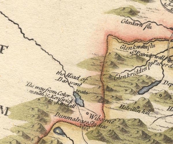 MD10NY31.jpg Approximate 10Km square, plus overlaps item:- JandMN : 24 Image © see bottom of page |
||||||||||
|
|
|||||||||||
| evidence:- | old map:- Bowen and Kitchin 1760 |
||||||||||
| source data:- | Map, hand coloured engraving, A New Map of the Counties of
Cumberland and Westmoreland Divided into their Respective Wards,
scale about 4 miles to 1 inch, by Emanuel Bowen and Thomas
Kitchin et al, published by T Bowles, Robert Sayer, and John
Bowles, London, 1760.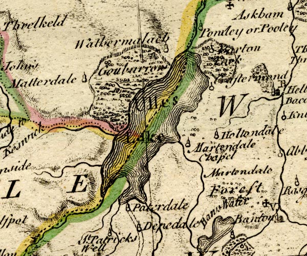 BO18NY31.jpg Approximate 10Km squares, plus overlaps item:- Armitt Library : 2008.14.10 Image © see bottom of page |
||||||||||
|
|
|||||||||||
| evidence:- | old map:- Jefferys 1770 (Wmd) |
||||||||||
| source data:- | Map, 4 sheets, The County of Westmoreland, scale 1 inch to 1
mile, surveyed 1768, and engraved and published by Thomas
Jefferys, London, 1770.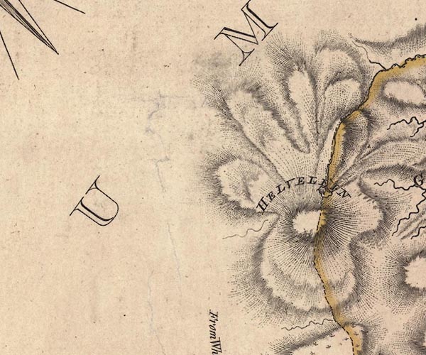 J5NY31NW.jpg 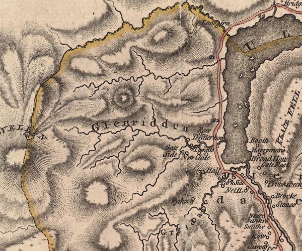 J5NY31NE.jpg 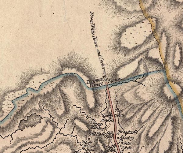 J5NY31SW.jpg  J5NY31SE.jpg Approximate 5Km squares, plus overlaps item:- National Library of Scotland : EME.s.47 Images © National Library of Scotland |
||||||||||
|
|
|||||||||||
| evidence:- | old map:- Donald 1774 (Cmd) |
||||||||||
| source data:- | Map, hand coloured engraving, 3x2 sheets, The County of Cumberland, scale about 1
inch to 1 mile, by Thomas Donald, engraved and published by Joseph Hodskinson, 29
Arundel Street, Strand, London, 1774. D4NY31NW.jpg  D4NY31NE.jpg  D4NY31SW.jpg Approximate 5Km squares, plus overlaps item:- Carlisle Library : Map 2 Images © Carlisle Library |
||||||||||
|
|
|||||||||||
| evidence:- | old map:- West 1784 map |
||||||||||
| source data:- | Map, hand coloured engraving, A Map of the Lakes in Cumberland,
Westmorland and Lancashire, scale about 3.5 miles to 1 inch,
engraved by Paas, 53 Holborn, London, about 1784.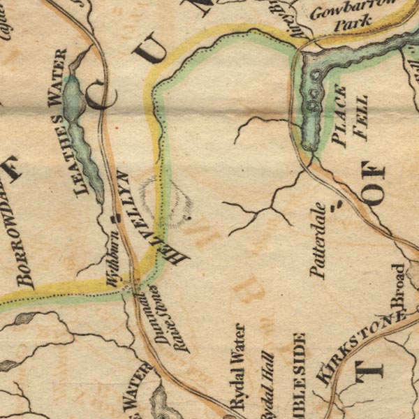 Ws02NY31.jpg Approximate 10Km square, plus overlaps. item:- Armitt Library : A1221.1 Image © see bottom of page |
||||||||||
| source data:- | 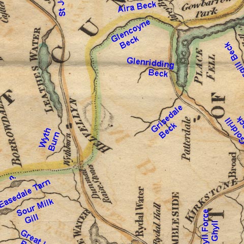 Ws2RNY31.jpg Rivers identified. |
||||||||||
|
|
|||||||||||
| evidence:- | old map:- Cary 1789 (Wmd) |
||||||||||
| source data:- | Map, uncoloured engraving, Westmoreland, scale about 2.5 miles
to 1 inch, by John Cary, London, 1789; edition 1805.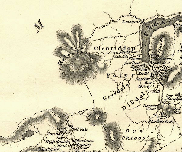 CY24NY31.jpg Approximate 10Km square, plus overlaps item:- JandMN : 129 Image © see bottom of page |
||||||||||
|
|
|||||||||||
| evidence:- | old map:- Otley 1818 |
||||||||||
| source data:- | Map, uncoloured engraving, The District of the Lakes,
Cumberland, Westmorland, and Lancashire, scale about 4 miles to
1 inch, by Jonathan Otley, 1818, engraved by J and G Menzies,
Edinburgh, Scotland, published by Jonathan Otley, Keswick,
Cumberland, et al, 1833.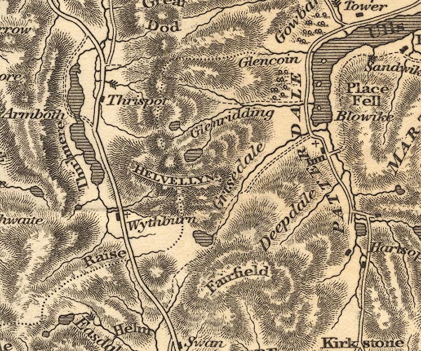 OT02NY31.jpg Approximate 10Km square, plus overlaps item:- JandMN : 48.1 Image © see bottom of page |
||||||||||
|
|
|||||||||||
| evidence:- | old map:- Ford 1839 map |
||||||||||
| source data:- | Map, uncoloured engraving, Map of the Lake District of
Cumberland, Westmoreland and Lancashire, scale about 3.5 miles
to 1 inch, published by Charles Thurnam, Carlisle, and by R
Groombridge, 5 Paternoster Row, London, 3rd edn 1843.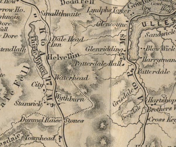 FD02NY31.jpg Approximate 10Km square plus overlaps item:- JandMN : 100.1 Image © see bottom of page |
||||||||||
|
|
|||||||||||
| evidence:- | old map:- Garnett 1850s-60s H |
||||||||||
| source data:- | Map of the English Lakes, in Cumberland, Westmorland and
Lancashire, scale about 3.5 miles to 1 inch, published by John
Garnett, Windermere, Westmorland, 1850s-60s.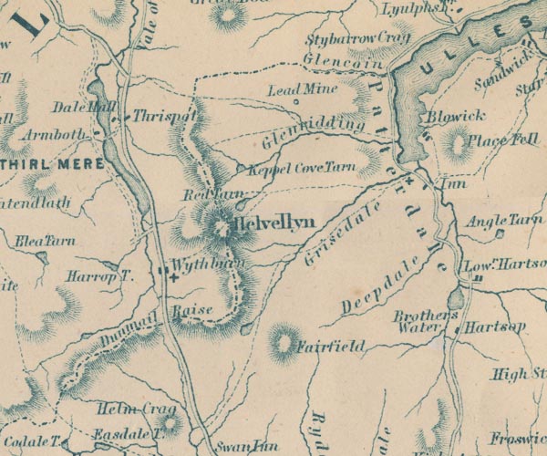 GAR2NY31.jpg item:- JandMN : 82.1 Image © see bottom of page |
||||||||||
|
|
|||||||||||
| evidence:- | old map:- Bell 1892 |
||||||||||
| source data:- | Map, colour lithograph, Road Map of Cumberland, by George Joseph
Bell, scale about 2.5 miles to 1 inch, printed by Charles
Thurnam and Sons, Carlisle, Cumberland, 1892.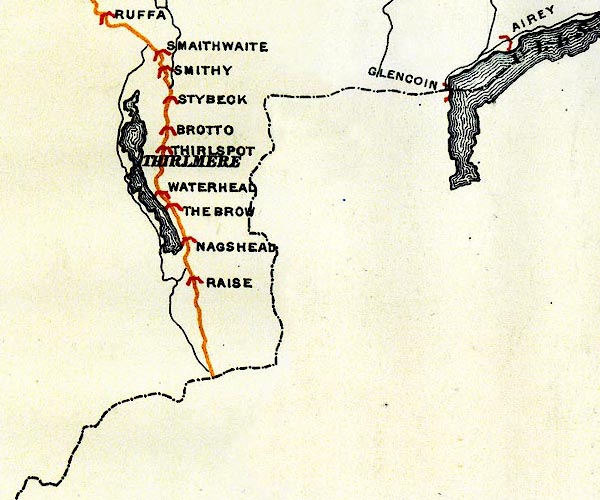 BEL9NY31.jpg Road map of Cumberland showing County Bridges item:- Carlisle Library : Map 38 Image © Carlisle Library |
||||||||||
|
|
|||||||||||
| evidence:- | old map:- Nurse 1918 |
||||||||||
| source data:- | Map, The Diocese of Carlisle, Cumberland, Westmorland, and
Lancashire North of the Sands, scale about 4 miles to 1 inch, by
Rev Euston J Nurse, published by Charles Thurnam and Sons, 11
English Street, Carlisle, Cumberland, 2nd edn 1939.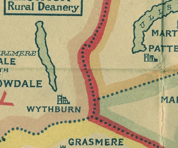 NUR1NY31.jpg Approximate 10Km square, plus overlaps item:- JandMN : 27 Image © see bottom of page |
||||||||||
|
|
|||||||||||
| evidence:- | relief map:- NASA data 2009 |
||||||||||
| source data:- | Relief map, digital image, Cumbria Relief Map, data downloaded from NASA, processed
by Jean M Norgate, Longsleddale, Cumbria, 2009; used to make a relief model, multilayer
jigsaw puzzle.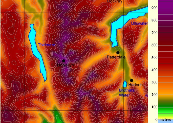 CH01NY31.jpg Cumbria Relief Map, created from raw NASA data, Jean Norgate 2009 item:- Norgate 2009 Image © see bottom of page |
||||||||||
|
|
|||||||||||
 Lakes Guides menu.