 Old Cumbria Gazetteer
 |
 |
|
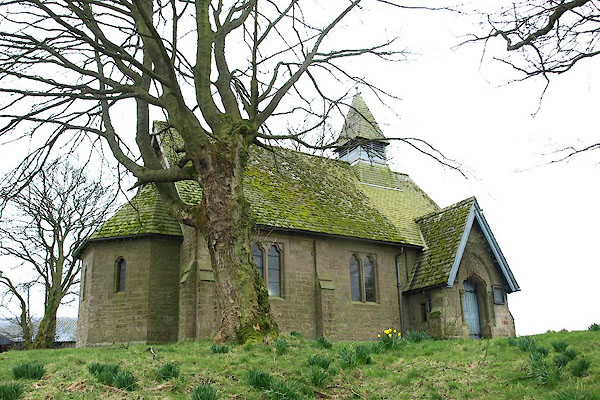
| St Kentigern, Kirkcambeck | ||
| St Kentigern's Church | ||
| Kirkcambeck Church | ||
| locality:- | Kirkcambeck | |
| civil parish:- | Askerton (formerly Cumberland) | |
| county:- | Cumbria | |
| locality type:- | church (disused) | |
| coordinates:- | NY53356895 | |
| 1Km square:- | NY5368 | |
| 10Km square:- | NY56 | |
|
|
||
 BOX57.jpg (taken 29.3.2008) |
||
|
|
||
| evidence:- | old map:- OS County Series (Cmd 12) placename:- Kirkcambeck Church |
|
| source data:- | Maps, County Series maps of Great Britain, scales 6 and 25
inches to 1 mile, published by the Ordnance Survey, Southampton,
Hampshire, from about 1863 to 1948. "Kirkcambeck Church (Remains of)" |
|
|
|
||
| notes:- |
There was a church here in the 11th century; only the doorway remains from the old
church. There is now a newer church, built 1885. |
|
|
|
||
 Lakes Guides menu.