 Old Cumbria Gazetteer
 |
 |
|
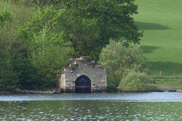
| boat house, Claife (3) | ||
| site name:- | Windermere lake | |
| site name:- | High Wray Bay | |
| locality:- | High Wray | |
| civil parish:- | Claife (formerly Lancashire) | |
| county:- | Cumbria | |
| locality type:- | boat house | |
| coordinates:- | NY37620040 | |
| 1Km square:- | NY3700 | |
| 10Km square:- | NY30 | |
|
|
||
 BPD30.jpg (taken 12.5.2008) |
||
|
|
||
| evidence:- | old map:- OS County Series (Wmd 32 2) |
|
| source data:- | Maps, County Series maps of Great Britain, scales 6 and 25
inches to 1 mile, published by the Ordnance Survey, Southampton,
Hampshire, from about 1863 to 1948. "Boat House / Jetty" |
|
|
|
||
 Lakes Guides menu.