 Old Cumbria Gazetteer
 |
 |
|
| boundary stone, Preston Richard/Stainton | ||
| civil parish:- | Preston Richard (formerly Westmorland) | |
| civil parish:- | Stainton (formerly Westmorland) | |
| county:- | Cumbria | |
| locality type:- | boundary stone | |
| locality type:- | parish boundary mark | |
| coordinates:- | SD53418696 | |
| 1Km square:- | SD5386 | |
| 10Km square:- | SD58 | |
|
|
||
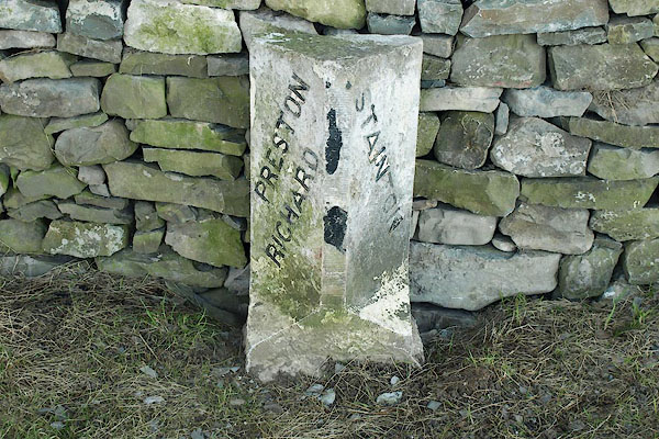 BQA60.jpg Inscribed stone:- "PRESTON RICHARD / STAINTON" (taken 6.2.2009) |
||
|
|
||
| evidence:- | database:- Listed Buildings 2010 |
|
| source data:- | courtesy of English Heritage "BOUNDARY STONE APPROXIMATELY 30 YARDS NORTH WEST OF STORTH END FARMHOUSE NEAR SUMMERLANDS / / / PRESTON RICHARD / SOUTH LAKELAND / CUMBRIA / II / 76521 / SD5338986972" |
|
| source data:- | courtesy of English Heritage "Boundary stone. Probably early C19. Dressed limestone upright stone with wide stop chamfers to front corners. Painted black and white with black sans-serif lettering diagonally on each chamfer: STAINTON to NORTH, PRESTON RICHARD to SOUTH." |
|
|
|
||
 Lakes Guides menu.