 Old Cumbria Gazetteer
 |
 |
|
| boundary stone, Dent/Sedbergh | ||
| civil parish:- | Dent (formerly Yorkshire) | |
| civil parish:- | Sedbergh (formerly Yorkshire) | |
| county:- | Cumbria | |
| locality type:- | boundary stone | |
| locality type:- | parish boundary mark | |
| coordinates:- | SD65429077 | |
| 1Km square:- | SD6590 | |
| 10Km square:- | SD69 | |
|
|
||
 BPW89.jpg (taken 9.1.2009) |
||
|
|
||
| evidence:- | database:- Listed Buildings 2010 |
|
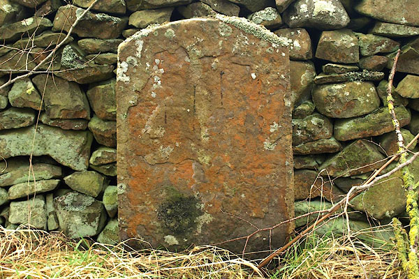
| source data:- | courtesy of English Heritage "BOUNDARY STONE ON WEST SIDE OF ROAD APPROXIMATELY 20 METRES SOUTH OF LANE TO CATHOLES / / / DENT / SOUTH LAKELAND / CUMBRIA / II / 484258 / SD6541390734" |
|
| source data:- | courtesy of English Heritage "Boundary stone marking boundary between parishes of Sedbergh and Dent. Probably C18. Sandstone. Flat-faced segmental-headed slab approx. 1 metre high, with worn inscription "D / S"." |
|
|
|
||
 Lakes Guides menu.