 Old Cumbria Gazetteer
 |
 |
|
| Dock Basin, Barrow Docks | ||
| Dock Basin | ||
| site name:- | Barrow Docks | |
| locality:- | Barrow Island | |
| locality:- | Barrow-in-Furness | |
| civil parish:- | Barrow-in-Furness (formerly Lancashire) | |
| county:- | Cumbria | |
| locality type:- | dock | |
| coordinates:- | SD20116728 (etc) | |
| 1Km square:- | SD2067 | |
| 10Km square:- | SD26 | |
|
|
||
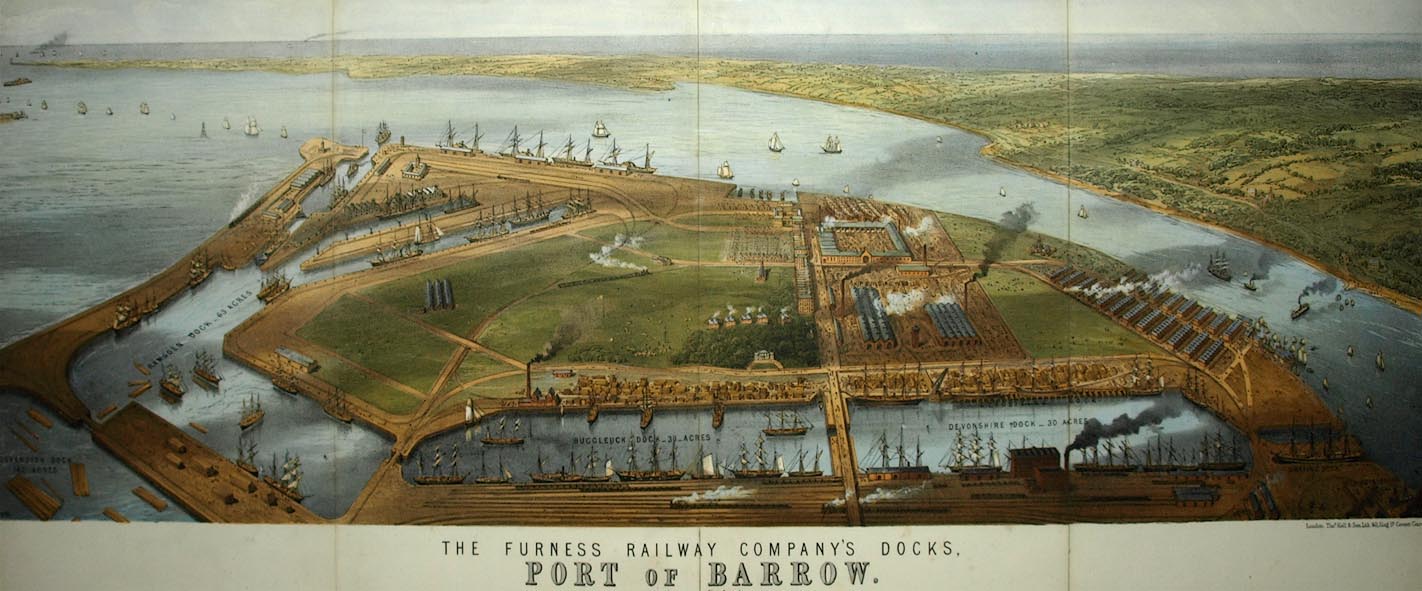 click to enlarge click to enlargeBPS81.jpg Aerial view. "THE FURNESS RAILWAY COMPANY'S DOCKS. / PORT OF BARROW." courtesy the Dock Museum |
||
|
|
||
| evidence:- | old text:- Admiralty 1933 placename:- Ramsden Basin |
|
| source data:- |  goto source goto sourcePage 381:- "BARROW-IN-FURNESS DOCKS. ..." "The principal entrance to the docks is at the southern end, through Ramsden basin and lock into Ramsden dock. Ramsden basin is entered through a gateway, which is 97 1/4 feet (29m6) wide with depths of 31 1/2 feet (9m6) over the sill. The lock between Ramsden basin and dock is 700 feet (213m4) long and 100 feet (30m5) wide." |
|
|
|
||
Lakes Guides menu.