 Old Cumbria Gazetteer
 |
 |
|
| How Mill, How | ||
| How Mill | ||
| site name:- | Hawkey Beck (?) | |
| locality:- | How | |
| civil parish:- | Hayton (formerly Cumberland) | |
| county:- | Cumbria | |
| locality type:- | buildings | |
| locality type:- | mill (ex) | |
| locality type:- | water mill | |
| locality type:- | corn mill | |
| locality type:- | saw mill | |
| coordinates:- | NY51005651 | |
| 1Km square:- | NY5156 | |
| 10Km square:- | NY55 | |
|
|
||
| evidence:- | old map:- OS County Series (Cmd 24 4) placename:- How Mill |
|
| source data:- | Maps, County Series maps of Great Britain, scales 6 and 25
inches to 1 mile, published by the Ordnance Survey, Southampton,
Hampshire, from about 1863 to 1948. "How Mill (Corn & Sawmill) / Sluice" |
|
|
|
||
| evidence:- | old map:- Donald 1774 (Cmd) placename:- How Mill |
|
| source data:- | Map, hand coloured engraving, 3x2 sheets, The County of Cumberland, scale about 1
inch to 1 mile, by Thomas Donald, engraved and published by Joseph Hodskinson, 29
Arundel Street, Strand, London, 1774.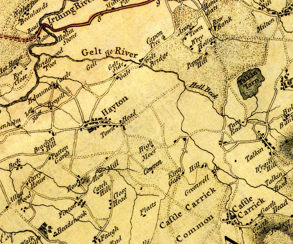 D4NY55NW.jpg "How Mill" circle with rays, mill wheel; a water mill item:- Carlisle Library : Map 2 Image © Carlisle Library |
|
|
|
||
| evidence:- | old map:- Ford 1839 map placename:- How Mill |
|
| source data:- | Map, uncoloured engraving, Map of the Lake District of
Cumberland, Westmoreland and Lancashire, scale about 3.5 miles
to 1 inch, published by Charles Thurnam, Carlisle, and by R
Groombridge, 5 Paternoster Row, London, 3rd edn 1843.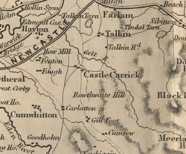 FD02NY55.jpg "How Mill" item:- JandMN : 100.1 Image © see bottom of page |
|
|
|
||
 Lakes Guides menu.