 Old Cumbria Gazetteer
 |
 |
|
| Cardurnock Lough, Cardurnock | ||
| Cardurnock Lough | ||
| site name:- | Cardurnock and Bowness Moss | |
| locality:- | Cardurnock | |
| civil parish:- | Bowness (formerly Cumberland) | |
| county:- | Cumbria | |
| locality type:- | tarn (drained?) | |
| coordinates:- | NY179582 (etc) | |
| 1Km square:- | NY1758 | |
| 10Km square:- | NY15 | |
|
|
||
| evidence:- | old map:- Donald 1774 (Cmd) placename:- Lough |
|
| source data:- | Map, hand coloured engraving, 3x2 sheets, The County of Cumberland, scale about 1
inch to 1 mile, by Thomas Donald, engraved and published by Joseph Hodskinson, 29
Arundel Street, Strand, London, 1774.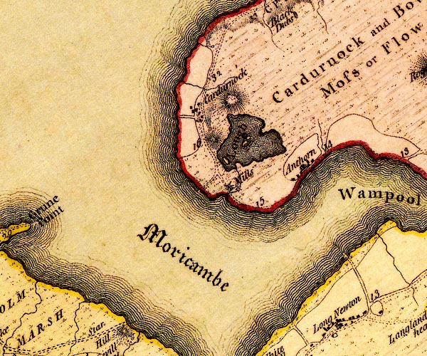 D4NY15NE.jpg "Lough" lake with islands item:- Carlisle Library : Map 2 Image © Carlisle Library |
|
|
|
||
| evidence:- | old map:- Cooper 1808 |
|
| source data:- | Map, uncoloured engraving, Cumberland, scale about 10.5 miles to
1 inch, drawn and engraved by Cooper, published by R Phillips,
Bridge Street, Blackfriars, London, 1808. click to enlarge click to enlargeCOP3.jpg outline, shaded; lake item:- JandMN : 86 Image © see bottom of page |
|
|
|
||
| evidence:- | old map:- Garnett 1850s-60s H |
|
| source data:- | Map of the English Lakes, in Cumberland, Westmorland and
Lancashire, scale about 3.5 miles to 1 inch, published by John
Garnett, Windermere, Westmorland, 1850s-60s.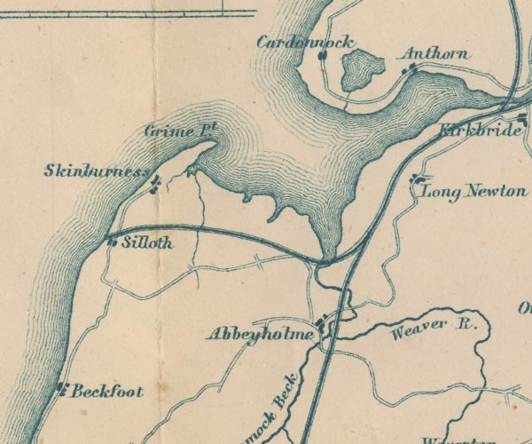 GAR2NY15.jpg outline with shore form lines, lake or tarn item:- JandMN : 82.1 Image © see bottom of page |
|
|
|
||
 Lakes Guides menu.