 Old Cumbria Gazetteer
 |
 |
|
| milestone, Threlkeld | ||
| site name:- | road, Penrith to Keswick | |
| civil parish:- | Threlkeld (formerly Cumberland) | |
| county:- | Cumbria | |
| locality type:- | milestone | |
| coordinates:- | NY30442400 | |
| 1Km square:- | NY3024 | |
| 10Km square:- | NY32 | |
|
|
||
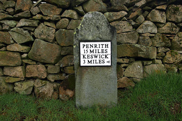 BPC74.jpg Cast iron on stone:- "PENRITH / 15 MILES / KESWICK / 3 MILES" (taken 2.5.2008) |
||
|
|
||
| evidence:- | old map:- OS County Series (Cmd 64) |
|
| source data:- | Maps, County Series maps of Great Britain, scales 6 and 25
inches to 1 mile, published by the Ordnance Survey, Southampton,
Hampshire, from about 1863 to 1948. "KESWICK 3 PENRITH 15 M.S." |
|
|
|
||
 Lakes Guides menu.