 Old Cumbria Gazetteer
 |
 |
|
|
| included in:- |
 road, Carlisle to Alston road, Carlisle to Alston |
||
| road, Carlisle to Kirkoswald | |||
| Carlisle to Kirkoswald | |||
| Kirkoswald to Carlisle | |||
| civil parish:- | Carlisle (formerly Cumberland) | ||
| civil parish:- | St Cuthbert Without (formerly Cumberland) | ||
| civil parish:- | Wetheral (formerly Cumberland) | ||
| civil parish:- | Hesket (formerly Cumberland) | ||
| civil parish:- | Ainstable (formerly Cumberland) | ||
| civil parish:- | Kirkoswald (formerly Cumberland) | ||
| county:- | Cumbria | ||
| locality type:- | route | ||
| 10Km square:- | NY45 | ||
| 10Km square:- | NY44 | ||
| 10Km square:- | NY54 | ||
|
|
|||
| evidence:- | old map:- Ford 1839 map |
||
| source data:- | Map, uncoloured engraving, Map of the Lake District of
Cumberland, Westmoreland and Lancashire, scale about 3.5 miles
to 1 inch, published by Charles Thurnam, Carlisle, and by R
Groombridge, 5 Paternoster Row, London, 3rd edn 1843.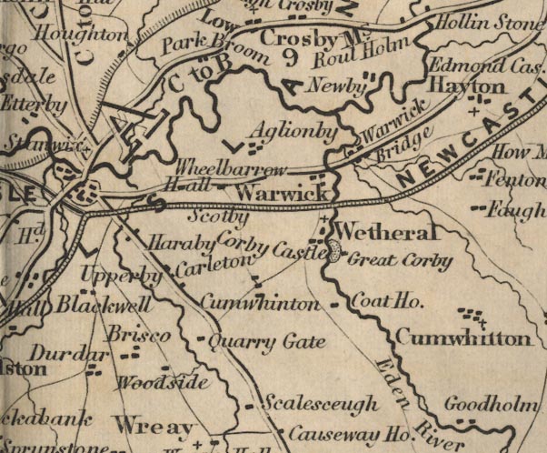 FD02NY45.jpg 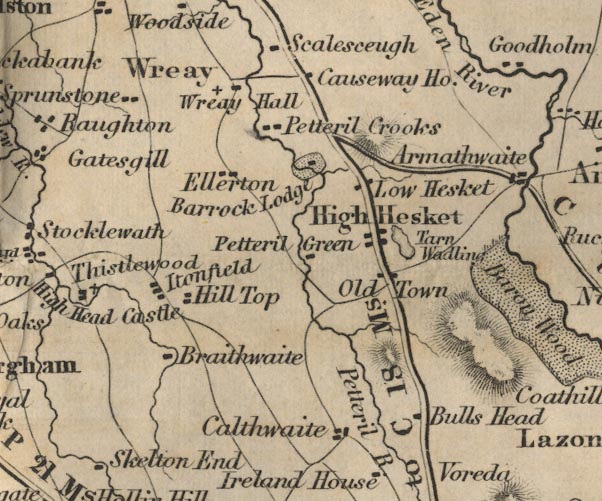 FD02NY44.jpg 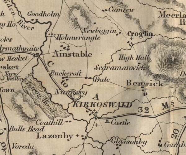 FD02NY54.jpg "C to A 32 Ms." item:- JandMN : 100.1 Image © see bottom of page |
||
|
|
|||
| places:- | Carlisle Cumwhinton, Wetheral Cotehill, Wetheral Armathwaite, Hesket Kirkoswald |
||
|
|
|||
Lakes Guides menu.