 Old Cumbria Gazetteer
 |
 |
|
| school, Cowgill | ||
| School House | ||
| Kirkthwaite School | ||
| locality:- | Cowgill | |
| civil parish:- | Dent (formerly Yorkshire) | |
| county:- | Cumbria | |
| locality type:- | school (ex) | |
| locality type:- | buildings | |
| coordinates:- | SD75878696 | |
| 1Km square:- | SD7586 | |
| 10Km square:- | SD78 | |
|
|
||
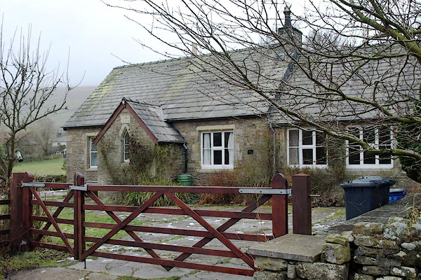 BPX08.jpg Plaque:- "KIRKThWAITE / ChURCh OF ENGLAND / SChOOL. / A.D. 1866." (taken 9.1.2009) 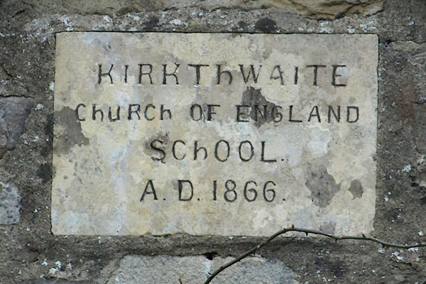 BPX09.jpg (taken 9.1.2009) |
||
|
|
||
| evidence:- | old map:- OS County Series (Yrk 64 15) |
|
| source data:- | Maps, County Series maps of Great Britain, scales 6 and 25
inches to 1 mile, published by the Ordnance Survey, Southampton,
Hampshire, from about 1863 to 1948. "School" |
|
|
|
||
 Lakes Guides menu.